On the Road in New Zealand

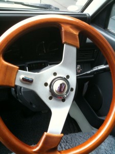
paulassteeringwheel

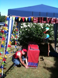
That’s jewelry designer Paula Martin’s steering wheel and we’ve been continuing our adventure. I stayed overnight at Falling Leaves B&B at romantic Lake Wanaka  (where the owner, Jo’s, water comes from her own well and tastes delicious. I can’t say I’ve ever enjoyed such good, pure water.) Paula, who is dedicated to her art and commitments, continued on to remote Nokomai, the scene of the last “fete,”  reached by driving down a very long dusty road off a main highway quite a ways south of Queenstown.

The next morning Jo drove me in her jeep from Lake Wanaka to Nokomai via the spectacular Crown Range route crownmtns2a narrow two-lane road with views not to missed. During the ride through the high mountains, Jo regaled me with stories of the Kiwi, a naughty bird that gets bored living near the snowy mountains and entertains itself by disturbing the material possessions of humans. The Kiwi bird enjoys removing windshields from cars, laces from shoes, and if there’s a laptop accessible, they will take it away. I hoped I wouldn’t encounter the Kiwi but I was assured the bird was “funny.”
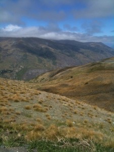
No wind when we arrived at the fete in Nokomai nokomai sponsored by “CRT,” a farmer cooperative operating in the South Island.  Remember, the day before we were at Queensbury when mammoth-sized winds hit and most of the exhibitors had to pull up their gazebos and exit quickly. Not so at Nokomai where the weather was perfect, sunny and warm. As Paula says, when the weather’s good, people open their wallets and she did quite well on Saturday.
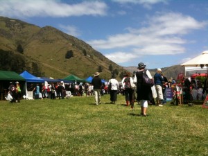
AT 5:30 p.m. we left Nokomai, driving down the dusty road to the main “highway,” and headed south for the funky Riverton, a town that should definitely be scouted for scenes in movies. Paula was excited about Riverton because she had lived there way back and told me about the “Globe Hotel,” where I would be staying. She would be sleeping in the camper van in the back of the very hotel that is for sale.
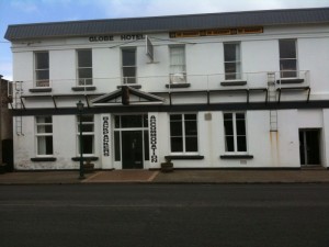
theglobe

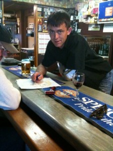
Riverton remains the kind of place that has not been developed yet. This is Scott scott the owner’s son who works at the Globe Hotel’s bar.
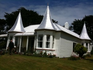
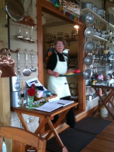
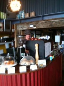
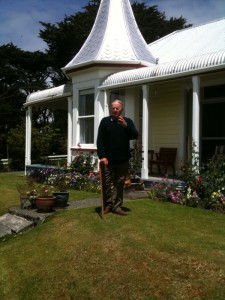
The next morning, Sunday, we had breakfast and coffee at Mrs. Clark’s Cafe in Riverton. coffeehouseriverton Next we  headed for the Fjords Great Views Holiday Park in Te Anua. Along the way we stopped at unique beaches with names like Monkey Rock where we met Mr. Watson who owns the  historic house called called  “the Turrets.” theturretswatson Paula had seen the turret house many times on her working drives during the Christmas season–but she had never gotten close enough to knock on the door. This time we did and we met Mr. and Mrs. Watson, who five grown children and 16 grandchildren. Mr. Watson’s passion is the history of the home he has lived in since 1960.  He married the following year. “The Turrets” has been featured in local history books and newspaper articles and Mr. Watson loves giving tours of the house and garden both Watsons have lovingly tended. In the darkened hallway there are oil paintings of Mr. Watson’s ancestors and he knows the stories behind all the nearby beaches like Monkey Rock (named so, because during the gold mining days, food and supplies were shipped down the coast and raised up a big rock with a monkey wench. Think I got that one right.
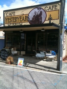
On the way to Te Anua, which isn’t exactly on the West Coast, but sort of close by, we stopped at a place called Tuatapere, where I had a little lunch, a cornish pastie, coffee and dessert.afterriverton2afterriverton
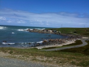
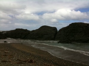
Paula drove us off the road to see some incredible beaches with names like Cozy Nook and Monkey Rockview You’ve probably heard that New Zealand looks like Northern California, and there are “familiar sights,” but here in NZ all is more more natural, more raw as Northern California beaches may have appeared a century earlier.  I’ve never been around so much nature in my life. unusualsight
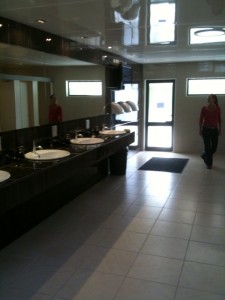
Last night which was Sunday in NZ, I stayed at the Fjordland Great Views Holiday Park—if you’ve never stayed in a motor park, NZ must have the finest. This is my first experience sleeping in a camper van and sleeping in rooms with and without bath at the motor parks we visit. Fjordland Great Views at Te Anau is stunning. I stayed in cabin #10. Behind my room which had a double bunk, tv and portable heater, there was a view of a field of sheep. [Of course, sheep can be seen all over NZ; still, to have them so close to my cabin was a visual treat.] What bowled me over was the ladies loo. Could have been part of a luxury hotel. loosloos2There is a heated floor and it’s been pretty cold in the mornings when I wake up–that icy kind of cold that comes with lakes after the snow has melted from the mountains. Paula Martin knows the motor parks and which ones are the finest; she has made friends with many of the owners as well and knows which ones take their business seriously. Fjord Great Views Holiday Parks is the most impressive motor park I’ve stayed at on this unpredictable adventure.
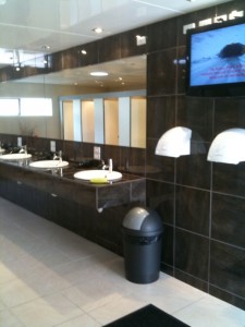
Later today we head back to the tiny place called Arrowtown where Paula has an appointment with a store owner. She made a good sale this morning here in Te Anau.
On the Road in NZ

paula'sbook

I was having a bit of a hard time, being so far from home, without Burt, my longtime companion who passed away earlier this year. We did everything together and were rarely apart. You know, it’s not easy suddenly being cut in half. Sometimes I can’t find me.

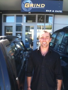
In Queenstown, Paula Martin,  my guide here in NZ, has a favorite coffee place called “The Grind”: it’s located in the industrial part of town. Meet Ben thegrind who owns “the Grind<‘ a cafe-bar with “the Remarkables” as a backdrop.
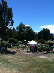
Today was a great day. Paula Martin and I slept at a motor camp near beautiful Lake Wanaka, which must remind Europeans of the Alps. Very early in the morning we took off for Queensberry, which once was a sheep station. Weather is always a main topic in NZ and we had heard about the expected mammoth winds and they arrived after lunch. Big bursts of air that took down everything in their path. Some of the exhibitors left early because their gazebos were collapsing. Paula and I dismantled her set-up early as well–it takes a long time to do it right and Paula has everything organized and nothing can be done out of order. It takes a couple of hours to pack up; hard work with mighty winds to contend with as well.

queensberry

Across the road from Queensberry there were plenty of sheep grazing in pasture framed by a beautiful mountain scene. Paula was going to set up her gazebo at this Victorian “fete” in the most spectacular of surroundings–all the people selling put up their gazebos in between huge white rose bushes. Hundreds of white rose bushes. Seems that the flowers we have back in El Granada grow to twice the size here in New Zealand.

[Image below: Paula setting up] I’m going out to dinner and maybe will have rabbit pie at an interesting pub/hotel in Wanaka. I enjoyed my “Betty Wilson’s Seafood chowder.”

settingup

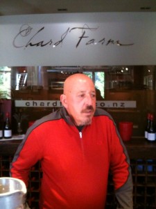
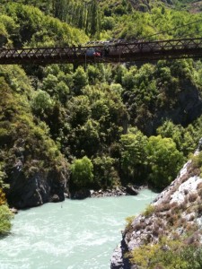
The day before we visited Chard Winery, accessible by driving over a narrow cliff-side road. cwinery At Chard, Dave is the man in charge of wine tastiing. chardNearby was the bridge where bungy jumping started. bungy2 On the flight from Auckland to Queenstown, I sat [way in the back of the plane] next to A. J. Hackett,  the founder of bungy jumping all over the world. When I told him I most likely was not going to give it a try, he wanted to change my mind. But I was “a hard case.”
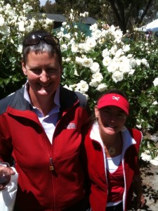
Tonight I’m spending the night at “Falling Leaves,” a lovely B&B near Wanaka.[Image: Jo, at left is the charming owner of Falling Leaves; at right, Paula Martin, silver jeweler.] jo

Lovely view from “Falling Leaves.” room

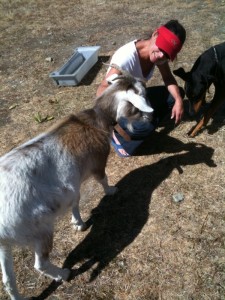
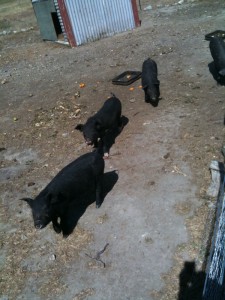
Tomorrow, Saturday here in NZ, I’ll meet up with Paula two hours away in a remote area where she’s setting up her silver jewelry at another “fete.” Jo, the owner of “Falling Leaves” has goats [the one in the image with Paula is called “Rasberry”] and black pigs on her ten acre property.

goatblackpigs

Leaving Queenstown….for a “fete”…..Cool, Bananas….

wr

But I broke my Canon camera.  Just tumbled out of my hands, hit the ground and cracked, in a quaint old gold mining village called Arrowtown.  (Still have my Flip & camera phone…)

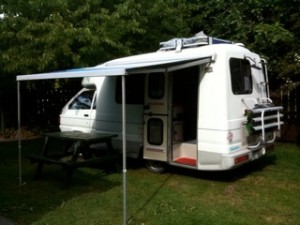
It’s lovely today but we may hit gale force winds on our long drive from Queenstown to a “fete” or fair near Wanaka. I’ll be helping Paula set up; after that show we head in the opposite direction to do another. Her van reminds me of an old Volkswagon bus, you get the picture? It’s be tough going in the van fighting GALE force winds.

More later….

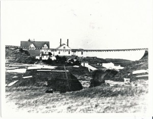
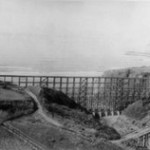
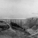
We asked the Ocean Shore RR experts: What does this photo taken at Montara mean?

-1

John Vonderlin: Hi June. Here’s the answers for your photo. The experts have done it again. That was fun. Enjoy. John
————-
Hi John [Schmale],
June sent me the photo of Montara Creek and the strange rail-like device suspended over it a while ago. Mr. Perkovic sent me an email after I sent him the picture and this is my reply. I’ll forward that to you next. Any thoughts about whether this could be OSRR or something else. Do you have a good picture of their sidehill trestles in this area? I’ve been unable to find a good picture of one. As you can see from my reply to Paul, I’m dubious this is the OSR rails, but rather unsure. I wish the picture was better resolution. Enjoy. John [Vonderlin]
———————
Hi, John,

Thanks for forwarding that photo.
I can only offer the following hypothesis: The view appears to be looking towards the west, with the main building of the lighthouse complex on the left, the foghorn building (with twin exhaust vents) in the center, and the smaller building that is now part of the hostel on the right. There appear also to be several smaller buildings on the west side of the strange rails. The viewing location seems to be at about the same level as the gound floor of the buildings. And the “strange rails” appear to be the Ocean Shore Railroad, suspended.
Highway 1 currently crosses Montara Creek with a culvert providing passage for the creek, and a significant amount of fill forming the base for the roadway. I suspect that the Ocean Shore Railroad might have also had an embankment or fill in the same location (rather than a trestle to span the creek), but with inadequate drainage capacity, and that a major flood washed out the fill. There are no signs of any trestle members still attached to the crossties, whereas fill and normal gravel bedding would simply wash out.
Maybe there is something in one of the Ocean Shore Railroad histories. I’ll keep this in mind as I wander around the area, and see if I can find an appropriate location for a photo.
Paul Perkovic
——————
Hi Paul,
Thanks for your thoughts. And the efforts to take the pictures you sent. I’m going to send the original picture on to a couple of OSRR experts who often can help us solve questions. I’ve attached several ScreenShots of photos from Californiacoastline.org. from the 70s and 80s of the creek area. I’ve also attached a trestle index from Jack Wagner’s book, “The Last Whistle.”  It shows no trestle from McNee to Pillarcitos. None of the stated lengths of the trestles without a set location are even close to the apparent length of the suspended stretch that is visible in the photo. There are 70 plus ties visible or about 100 feet. Given the absence of any close slope to where the rails disappear to left and right on the photo I’m thinking a 150 foot minimum. That’s if we were looking at railroad tie spacing of about 18 inches.  Many of them aren’t well-spaced or as parallel to each other as they should be, even after a flood that had undermined their footing. In some places there are sections with a number of widely spaced ties in a row, which is hard to do without bunching elsewhere, which I don’t see. Other places the ties have alternate slants, which would seem to be hard to duplicate without them being loose from the spikes. Then there is the weight of that much railing…how is it strung so straight across the gap, with so little bowing to gravity? How does unwelded rail stay together with that pull on it?
The following excerpt from an old newspaper article about the Spring Valley Water Works hints at a possible pipe or flume support spanning a gap that sounds like this same circumstance. Could that “rail” assemblage have supported an iron pipe across the gap before the flood? Or was one to be installed but the rain delayed it? Did Montara ever have a waterline running down from the north along the coast road? Either a flume or iron pipe?
. Thanks for your help in solving this puzzle. I’ll notify you of developments. Enjoy. John
“until it reaches what is known as the San Andres Valley, which it crosses by a heavy iron pipe, a distance of about fifteen hundred feet, and thence the level is undisturbed into town. A similar pipe, or perhaps a wire suspension bridge will be needed at the gap next the Abbey, known as the “Portasuelo,” for the flume to pass over.”
——————-
Hi John et al,

The photo in Wagner’s book shows the the Ocean Shore RR tracks  at Montara following a flood caused by a very intense storm. The storm water backed up behind the railroad fill to a depth of  over 40 feet. On January 13, 1916 the clogged culvert passing under the railroad fill was blown up using dynamite. The resulting torrent of water tore away the railroad embankment as well of that of the highway. The photo was taken after the fact showing the tracks suspended in air. The tracks are bolted together through “fish plates.” A trestle was built to replace the fill. Many slides up and down the line closed the Ocean Shore for over a month. I hope this helps
John Schmale
The local water company installed a dam in the creek just up stream from the Ocean Shore Railroad tracks
————————-
Hi, John. Thanks for your email and attachments re above. Info I find on the Internet is that on mainline track (in 1988) ties were spaced at 19.5″ centers and somewhat more on sidings, yard tracks, etc. What standards applied in the early 1900s I don’t know, and whether the OS followed them with any precision I’d say is doubtful.
The reason the washed out rails hold together is that fish plates (metal bars with bolts) hold the rail ends together as intact units– see the picture under fish plate in Wikipedia.  I sometime ago found a story and picture of the (I believe) same washed out trestle and the Montara flood (dumb me, don’t think I kept it; but will recheck my OS Favorites and if find will forward.  I believe this was the trestle at McNee; extremely unlikely this is the southernmost step or sidehill trestle, which  type had one side of the track supported by the hill or mountain and the other side by pilings/trestle-work,  and it is  not the Pilarcitos trestle at Half Moon Bay.  Since the Trestles page in Wagner’s OS book stems from the 1911 Bondholders Report of the Ocean Shore Railway and if the flood was prior to that date (was it 1909?) then the replacement trestle may have been somewhat shorter or longer depending on embankments at the ends. Incidentally, when I replied on a recent email to John Schmale and cc’d  to you and June, I wished John and his wife a Happy Thanksgiving, but neglected to include you and June.  It’s not  too late, and so Happy Thanksgiving to you John and to your mother, and to June.   Angelo

Queenstown: Wednesday Morning

Home: home

Time-wise, I am three hours behind, and one DAY ahead of the clock in Half Moon Bay. I just took my shower in the motor park where I spent the night sleeping in Paula’s van. Yesterday we went to the Warehouse, a discounter located in the “Remarkables” shopping center, to buy one sheet and a duvet for my bed.  The van is a tight fit but it works.  A narrow bench, upholstered in a vibrant red material pulls out to become a “bed,” which although it does not have a soft surface, put me right to sleep. We are parked near the kitchen which is outfitted with a stainless steel cook top, big screen tv, and internet hook-up. The “bathrooms” with shower are individual little buildings, three of them, with more in the main building–but not all the motor parks are going to be this comfortable.

We had a delightful lunch yesterday at Paula’s favorite place called “the Grind” in the industrial area of Queenstown.

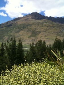
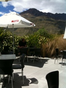
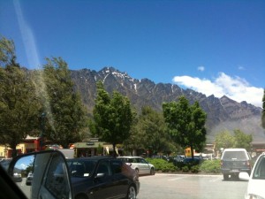
We cannot escape “the Remarkables” but there are mountains everywhere, the kind that loom and let you know how small you really are.

Paula reminds me that we are sitting on an island in the middle of nowhere, subject to the whims of weather. Right now it is a bit sunny with some wind. She says wind is common this time of year. The weather is constantly changing and she says when it stays the same for a couple of hours it’s the big top of conversation here.

paula

Paula Martin, my companion and guide, is a silver jewelry designer and native New Zealander. This is the time of year when she makes her pre-Christmas jewelry sales by driving through the South Island visiting shops and setting up at fetes, in this case one at a very remote location, which we are going to do later this week.

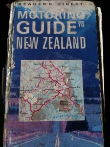
Last evening we sat in the van and sipped some bubbly as she pulled out her well worn (and beloved) maps of New Zealand, telling me stories about all the entirely original places she knows so well. She described birds to me with voices that chime, glaciers that move, and the terrain which you have to experience first hand to understand.

Queenstown, NZ

Re1Re2

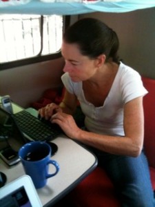
My friend, Paula Martin, the silver jewelry designer, met me at the Queenstown, NZ airport this morning. We got in her van and we were off on an adventure that will entail visiting fairs on the South Island where she will sell her work for the Christmas season–and, of course,  we will be fully enjoying the local scenery. For now we are in Queenstown; I’m working on writing projects while Paula is organizing her jewelry.

Flying into Queenstown was an incomparable visual experience—you wouldn’t believe it—we flew in inbetween the mountains, low, and with the mountains on either side.  All the water forms here, the lakes, are an intense azure blue, the blue you might find in the artist’s paintbox, or in your imagination.  No gray-blue like the Pacific Ocean.

Overlooking the airport and Queenstown are “the Remarkables,” a set of  mountains, tall and pointed. They can be seen from almost everywhere and overlook the shopping center with the same name.

Re3

John Vonderlin: I Found Phony Sea Glass at Skullduggery Cove

Story by John Vonderlin

Email John: [email protected]

seaglass1seaglass2

Hi June,

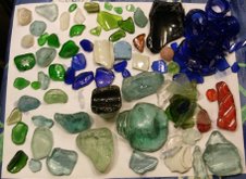
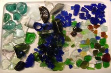
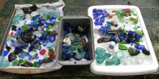
One of Sir Walter Scott’s, most famous quotations is, “Oh. What a tangled web we weave, when first we practice to deceive.” Well, thanks to a bit of serendipity and our carefully nurtured cynicism, I believe we’ve discovered a situation that exemplifies the quotation’s message, a situation that might best be described by a similar-themed Scottish word, “skulduggery.” Somebody actually tried to carry out the deception of producing natural sea glass “gems” by finding an isolated and difficult-to-reach cove along the Coastside, and dumping a large collection of glass chunks, many of rare colors and types, into the gravel there, hoping for time and tide to give them an “authentic” surf-created polish, so prized by sea glass collectors. Well, they got lucky. because I found the scene of their crime, forthwith named Skulduggery Cove, and cleaned it up for them. While I don’t know the details of the law, I’m guessing dumping sharp pieces of glass into the Monterey Bay Marine Sanctuary, and thereby on a San Mateo County beach, for profit, is probably a big No! No! Now, I may be wrong about the “profit” part, and this is just an obsessed, misguided collector/artist, doing this. But, the circumstantial evidence says otherwise as I’ll outline in a future posting. As you remember, I posted briefly a few weeks ago about having the greatest sea glass collecting event in my life. Yet, I believed it might be a case of having to look a gift horse in the mouth and yell foul. That instead of having stumbled on a King Tut-ish trove of sea glass, I had stumbled on a counterfeiting operation. The PhD of a hoaxster graduate of the “Piltdown Man School of Shenanigans.” Well, having returned to the scene of the crime twice more, each time collecting a wonderful, if diminishing, assortment, of colorful glass chunks, I now have a more nuanced view of the whole enterprise. But, that might be because I’ve now collected enough sea glass to fill a large glass container, with which I’ll create a piece of artplay. I’ll be calling the piece, “Chicanery Glass.” I’m also expecting to enjoy myself writing a series of postings about this delicious subterfuge and all the subtle flavors wafting from it. Here’s an excerpt from my description of how this came to light on my first trip: …….Such was the case Monday, though the low tide was only a minus -.5. Picking out one of the difficult to reach, except during a good low tide, stretches of our coastside beaches, we soon were exploring. This particular stretch, south of Pigeon Point, has been our most reliable and prolific producer of abalone shells, including many complete ones. And though we don’t collect them, it’s fun to gather them and pass them on to a local artist for use in his creations. We weren’t finding many, which wasn’t surprising, as others surely had combed this stretch since the big storms of last winter. Still, I had my “Search and Find” circuits alert for small, easy to miss, yet attractively polished pieces. Hiking south we had carefully worked our way over the slimy rocks jutting from the end of a point and into a small pocket cove, I was delighted to see two pieces of cobalt blue sea glass, one of the rarer colors, nestled in the pebbles. Excitedly looking about, I found another, and another, then a piece of an unusual color of green, and then more blue. So it went, dozens of pieces of blue, interspersed with other unusual colors, with just a few of the common clear, brown or green found in so many beer or soda bottles. I was just thinking how this was the best collecting I’d ever done when “Eureka,” I spied a nickel-sized piece of red glass. I had never before found even one piece of this very rare color. Admiring it for just a second as I turned it over in my hand, I quickly cast my focus about my feet again and saw another. “Let me die now cuz it don’t get better then this,” I’m thinking. How wrong I was. As I moved up the beach to the base of the cliff I continued finding a rainbow of colors, along with a number of larger pieces, some that I quickly identified as parts of glass insulators, popular collector’s items themselves. Sea glass collector books opine that larger pieces, through some dynamic of the waves, tend to end up higher on the beach. This was the case here as the gravel at the cliffbase was smothered with a heaping helping of tasty specimens. I should mention. I’m not actually a sea glass collector. I do have a sea glass collectiom that fills several ornate clear vases, but it’s just another exhibition of a variety of non-buoyant marine debris, rather then a collector’s pride and joy. While I do admire the gemlike, polished contours of “Mermaid’s Tears,” the general lack of a history of dumping glass into the ocean along the southern Coastside, makes for slim pickings locally. That’s especially true for any color that didn’t originate from a beer bottle. This just was not the circumstance that generated much collecting enthusiasm in me. At some point, as I kept mining this bonanzic Mother Lode of treasure, where there should be none, cynicism crept in. Why had we seen none of this in any previous hikes through this cove? How could the majority of the pieces be of the rarer colors? And how come some of the pieces are sharp and fresh looking, while others are highly polished? I’ve been presented with a veritable enigma-stuffed conundrum slathered with a secret mystery sauce. Assuming deceit, why had somebody gone to all the trouble? When did they start? What were the pieces of unusual glass from? Where had they been acquired? Were there preliminary steps before leaving them at the beach? Who does this deceit offend or hurt? What is its value? I’ll try to answer these questions in Part 2 of “Chicanery Glass.” Here are photos of the booty from my second and third visits to Skulduggery Cove and one picture of the my complete collection, so far, of “Chicanery Glass.” Enjoy John

seaglass3

I am with the Kiwis….

That’s “Slater,” at the bottom right. He’s part Maori, part Scottish, there are few to no full-flooded Maoris living in NZ. After a 13 hour flight, I landed in Auckland, the big city, where most New Zealanders live. Slater showed me around during my one night stay in Auckland, the “City of Sails.”
You should see the harbor; it’s filled with sails, most of them of the vary largest variety, couldn’t imagine one of these at Pillar Point Harbor. One of the biggest yachts I have ever seen is called the Ulysses.

IMG_0431

IMG_0470 IMG_0496

John Vonderlin: The Yellowed Pages

Story by John Vonderlin

Email John: [email protected]

-1 -1

Hi June,
I’ve been researching that book that I sent you all the ads from. It is on Archive.org and is entitled, “Handbook and Directory of Santa Clara, San Benito, Santa Cruz, Monterey, and San Mateo Counties.” It was produced by Luther L. Paulson in 1875, part of series covering all of the Pacific coast, of which he apparently produced only four, covering most of the coastal or near-counties of California. The other three were produced in 1874 and 1876; one for Southern California, one for the northern counties of the Bay Area, and one for Alameda County.
They are essentially  “Yellow Page” style books, that businesses could buy a full page advertisement in for $20, or a half page for $15, or a quarter page for $10. But, they were much more too. They all included a list of the post offices of the Pacific Coast. Also, each included what was purported to be a complete listing of every permanent resident of the respective counties they covered, with those people’s occupation and postal address.
For the county of San Mateo there are more then 40 pages, with about 65 people a page, over 2,500 people. Farmer, dairyman, laborer, trader, wagonmaker, barber, clerk, blacksmith, teamster, lumberman, machinist, engineer; they’re all represented. It’s a comprehensive look at who was where, and doing what, in the still raw county of San Mateo in 1875.
Even more fascinating are the local ads. Ads for stagelines, liveries, a millinery, druggist and chemist, attorneys, a butcher, saloons, hotels, a flouring mill, general merchandisers, saddle maker, physician and surgeon, and of course, undertakers are all proudly displayed. Many of these ads have high quality drawings or quite fancy layouts.
There are also short descriptions of several of the cities in San Mateo County, and there used to be maps of the covered counties in the book, but they, along with a few other pages, seem to be missing.
These four volumes seem to be the height of the publisher, Luther L. Lauson’s, career. I can find no mention of him, other then related to these books, anywhere else. The printing company he used, “Francis and Valentine Steam Press” was well known, and apparently the largest printer on the Pacific coast for many years. They specialized in doing jobs for those lacking their own presses, and have a full page ad for themselves in the book.
Unfortunately, on Christmas Day, 1893, a fire broke out in the block where their plant was located, as well most of the other printing companies and newspapers located in San Francisco at that time, and their many presses were destroyed. They never fully recovered, and another fire in the same building, five years later, forced them into bankruptcy. While Mr. Paulson’s endeavors may not have been a great financial success, they leave us with a fascinating view of the financial vibrancy of the early days of San Mateo County. Enjoy.
I’ve attached some drawings from the “Morning Call” and the “Call,” and part of the article about the fire, as the papers were not damaged severely by the fire, and were able to keep publishing.

-2

John Schmale: The Tunitas Creek Ocean Shore Railroad Depot & Angelo Misthos Responds

Story by Railroad author John Schmale

Email John Schmale: [email protected]

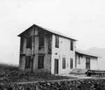
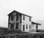
tunitasdepottunitasdepot

Hi June,

I am sending the two Tunitas Ocean Shore Railway photos as jpegs. I hope they open alright. The one of the trestle missing it’s north end was from about 1938.

trestletrestle

The photo of the Tunitas depot dates from the same time period. I recall during the late 1960s seeing the ruins of the depot after the fire. It was a great loss to me as a railroad fan. The photos are from my collection via Rudy Brandt. Rudy Brandt or Robert McFarland took  the photos.

Regards,

John Schmale, author of Arcadia book:  Petaluma and Santa Rosa Railroad

——————————

Story by Angelo Misthos

Hi, John. Thanks very much for the Tunitas Long Bridge and station
photos–which opened up fine.  I remember the station and its loading
platform, but didn’t go down to take pictures or examine it more closely–I
had only a box camera during those Depression days and don’t think I had it
with me. I think the station had galvanized siding, or maybe just the roof.
As I drove by with my friend  (who’d borrowed his brother’s Model A Ford )
on our way to Santa Cruz, all that remained of the trestle was on the South
side up to about the first x-shaped reinforcements between bents. I was
driving and had just gotten my driver’s license at age 16;  this places the
year as 1939.  Since the photo you sent dates to about 1938, this jibes
with my hunch that the trestle was being dismantled from the north end,
though
I don’t recall seeing any such activity or equipment as we went by.  Angelo