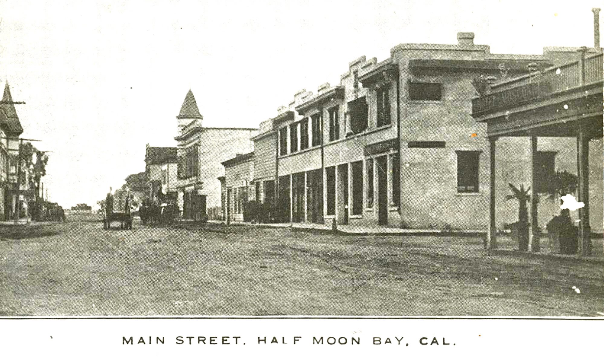
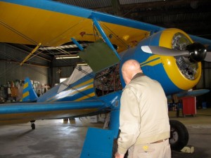
Sebastian Belli, who lived in Moss Beach in the 1930s, built the Half Moon Bay Inn at Mill and Main, now home to “It’s Italia.” Handsome, isn’t he?
Oh, and this image was taken at the HMB Inn.
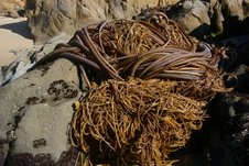
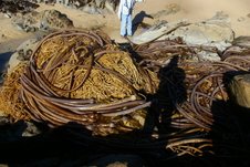
While You Slept: John Vonderlin’s Been Out There Collecting
 Story by John Vonderlin
Email John: [email protected]


Barry Parr: On Local Politics…And the Winners Are
Story by Barry Parr
Check Coastsider for complete results, but the current city council majority
slate swept the field in Half Moon Bay.
In Granada Sanitary District, incumbents Ric Lohman and Gael Erickson won,
and incumbent Leonard Woren leads challenger Lisa McCaffrey by a single
vote.
In the Coastside Fire Protection District, challenger Gary Riddell and
incumbents Gary Burke and Ginny McShane have won.
In the Coastside County Water District, incumbent Chris Mickelsen and Jerry
Donovan have won.
More details:
June Morrall: Climbing Old Pedro Mountain Road
Yesterday, my cousin and I hiked up Old Pedro Mountain Road, with our lofty goal the very top.
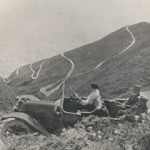 Automobiles once traversed the tricky turns on the Old Pedro Mountain Road and it could challenge San Francisco’s famous Lombard Street as the road with the twist-iest (and most spectacular ocean and landscape views) in the world.
Not a boring moment along the road that goes up and up and up—if you choose to keep going up and up and up. The morning was warm with a good, welcome breeze that cooled us off—and on one sharp turn a little stand of pine trees responded with a musical sound as the wind mussed up their needles.
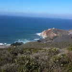 Along the way we encountered other hikers, many young, couples, and several singles, most with dogs, some with dogs whose coats were highly polished revealing the owner’s relationship with their pets. A standout for me was the blue-black colored dog, his coat so slick that it reflected sunlight, and I know he, the dog, heard me praise his beauty.
When I say we met other hikers, I am not talking about a great number. It’s surprising how few people were walking along the trail on that post-Halloween Sunday morning.
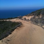 A lot of the walkers were going in different directions because there are other feeder trails than the one that goes directly to the top, that very elusive top of the mountain, I should add.
One of my repeated questions was: How far to the top? “An hour”, somebody said, this after we’d been walking for an hour and a half and the terrain was getting seriously steep, and we were at the point where we longed for the mercy of flat, level land. Another woman cautioned: “Go where you want to go. We didn’t make it to the top, it gets almost vertical.” She didn’t need to use her hand to show me what vertical looks like.
 Yikes: It gets almost vertical. Visions of how hard it was going to be to walk down the trail danced in our heads. Another hiker reminded us: “You use different muscles when you come down. Your toes move to the front of your shoes. The dirt is loose in places.” Those thoughts began to squash the goal of making it to the top.
When we reached our limit, that is, as far as we were going to go on that morning after weighing the information we had gathered on our way up, I wondered outloud if there was, or should be, some way to register our foot mileage.
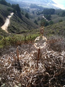
Okay, we didn’t make it to the very tippy- top yesterday but how many people HAVE made it to the tallest peak on old Pedro Mountain Road? And who are they?
—————————–
Addendum: You may notice that the permanent image on my blog page is of a woman with a dog sitting high up on a mountain. That’s me, with my dog, Scorpio, and we hiked up Old Pedro Mountain Road in the 1970s. I don’t think I made it to the very top that day either.
John Vonderlin: The Water that might have been (Part I)
Story by John Vonderlin
Email John: [email protected]
highway transportation
facilities to be constructed during
the
coming decade will allow the coastal area of San Mateo
County
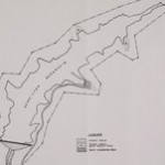
to participate in the rapid growth of the San Francisco Bay Area. This growth will be accompanied by increasing demands for water supplies and fresh water recreation opportunities. The studies also revealed that the water requirements of this area could be met by development of local streams. A number of damsites were evaluated and six staged development plans were
formulated
and tested for economic justification. An economically justified staged development plan which offers the opportunity to maximize the net benefits accruing to the coastal area is recommended for feasibility study by the local people.”
“Continued
population growth and increasing demands for developable land in the San Francisco Bay Area will exertgreat urbanizing pressures on the coastal area of San Mateo County south of Montara Mountain. This area is the last large, close-in district on the peninsula suitable for development. Urban growth will bring increasing demands for municipal and industrial water supplies.”
“Projections
of population for the coastal area indicate an increase from 7,635 persons in 196O to 118,000 in 2020 and to about 238,000 under conditions of maximum development. This great increase will result from the development of the coastal area as a “bedroom area”. This growth will be made possible by the completion of modern standard highway transportation facilities which will allow the working force of the coastal area to commuteto other parts of the San Francisco Bay Area.”
analyzed
to determine if the supplemental water requirements could be supplied by local development. It was found that there were adequate supplies of good quality water for all beneficial uses.
Having
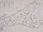
determined that available, physical worksadequate local runoff was to conserve this runoff were evaluated. A total of 43 dam and reservoir sites were studied. Twelve of these sites were given detailed study and were considered, together with appropriate diversion and conveyance facilities, to be possible units of staged development plans to meet the supplemental water requirements of the area. Six alternative staged development plans were formulated. The units of each plan were staged to the year 2020 and the additional units required to meet the estimated maximum supplemental
plan was tested for economic justification for a 50-year period of analysis from 1970 to 2020.”
1.
Denniston2. Purisima No. 1
3.
Purisima No. 2
4.
Lobitos
5.
San Gregorio No.2
6.
Pescadero
7.
Loma Mar No. 2
8.
Worley
9.
Juanita No. 2
10.
Bean Hollow
11.
Pigeon Point
12.
Gazos No. 1
Whitehouse
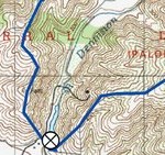
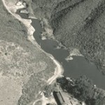
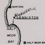
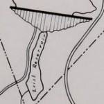
quarter of Section 2, Township 5 South, Range 6 West, MDB & M, approximately one mile north of El Granada. A mathematical operation study was made for a 4,500 acre-foot reservoir. Small mandatory releases were allowed
for
existing water use and a pool of 250 acre-feet was reserved for sediment deposition and fish. The net yield was 1,300 acre-feet per year.
Recreational
development in the reservoir area is now
limited
to a rifle and pistol range operated by the Brisbane Rod and Gun Club. Poor access, rather steep slopes, limited area available for development, and a lack of trees, make the overall reservoir recreation potential relatively poor.
Fish
and Game resources of the watershed are not
utilized
to any degree. The reservoir would cause the loss
of some
quail habitat, but would not adversely affect other species of wildlife or the small resident trout population. With proper management a self-sustaining population of warmwater game fish could be supported. A mathematical operation study was made for a reservoir
with
a capacity of l6,800 acre-feet. Allowing a sediment,
recreation, and fish
pool of 1,000 acre-feet, a net yield of 3,900 acre-feet per year could be obtained. The reservoir recreation potential is only fair because of the open cover pattern and the scanty tree cover. There are some trees in the canyons, but most of the drier
slopes lack even
brush cover. Access is good and most recreation uses could be accommodated, but the size of the reservoir would limit the amount of use.”
Now with an expected production of just about enough for 1,500 homes, this reservoir was slated to be only a small part of “The Big Picture.” In the document they detail six proposed plans, involving different combinations of reservoirs, that they were considering. I’d like to share their favored plan and some its components in future postings. I think you’ll be startled by the size and scope of their plans and the changes they would have wrought to the vista as we know it today, if they had ever been brought to fruition. Enjoy. John
Bach Dancing & Dynamite Society (BDDS): Pete’s PICK ….MOIRA SMILEY & VOCO…SUNDAY NOV 8
 (BDDS) Pete Douglas says: Come see Moira Smiley & VOCO on Sunday, November 8. They’re folk singers.
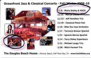
(BDDS) Linda Goetz says: Next Sunday, Nov. 8th, Pete booked some really interesting folk vocalists – part of our World Music variety. It’s not Jazz or Classical. Thought you might be interested. Would be nice to see some of my friends here. You can check out their music on the links below.
http://www.myspace.com/vocoinfo
http://www.kailaflexer.com/html/teslim.html
http://eliyahusills.com/qadim/qadim.php
Halloween: Frank & Fanny
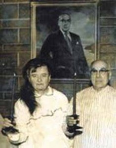
Fanny & Frank Torres, once the owners of restaurants in Moss Beach and Montara, including the Distillery, loved to dress up for the holidays. Here they are in Halloween attire—and behind them is the painting I have written about–the one of Frank Torres, wearing suit and tie, with Devil’s Slide behind him.
Thanks to the Millicent Muller for the image.
RIP Frank Sylvestri: The Half Moon Bay Airport Was All About Frank
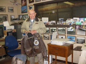
Frank Sylvestri WAS the Half Moon Bay Airport; his hangar was called “West Coast Aviation,” with a giant cartoon of Snoopy on the roof. You know the one. You’ve seen it a million times driving south toward Half Moon Bay.
The former WWII pilot passed away on Wednesday, his son, Paul told me today.
The road parallel to Highway 1, leading to the Three-Zero Restaurant at the Half Moon Bay Airport is called “Frank Sylvestri Way.” Isn’t it nice when the County names something after a real local person?
In 1950 Frank became the manager of the airport, holding that position for nearly three decades when he decided to start up business in his famous hangar called “West Coast Aviation.” Oh, and you know in that classic 1957 movie “The Spirit of St. Louis”, starring James Stewart–it isn’t Stewart piloting the plane with the same name as the film—it’s our own Frank Sylvestri, a very good reason to rent the movie. Some of the scenes were filmed in Princeton-by-the-Sea.
If you want to know more about Frank, please visit the restaurant, enjoy a meal, and read the plaque on the wall. It’s all about Frank.
Double Take:: Is that Mary Poppins posing with the children from El Granada’s “Kids By the Sea” School?
You should have seen Mary Poppins skittle across the street, with the kids in tow. She was Mary Poppins, yes she was.


Do you know the official name of the San Francisco-Bay Bridge?
The official name of the San Francisco-Bay Bridge is the “James ‘Sunny Jim’ Rolph Bridge. Sunny Jim Rolph was a local boy born in the Misison District and the Republican was San Francisco’s longest serving mayor (1912-1931).

To view old postcard photos of the Bay Bridge, please click here
