Ken LaJoie: The Coastside Cliffs Were His Beat In 1980, Part I

KenLaJoie.jpg

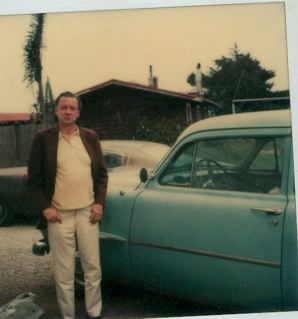
Geologist Ken LaJoie, the cameraman and I were standing on the cliffs near Surfer’s Beach in 1980. Surfer’s Beach is located across Highway 1 from El Granada, the town founded by the Ocean Shore Railroad. I was interviewing Lajoie as we shot footage for “The Mystery of Half Moon Bayâ€?.

Ken worked for the USGS in Menlo Park and had been measuring cliff erosion on the Coastside for years. These are his comments more than 20 years ago—it would be fascinating to hear what an expert says today—since 1980 there has been a lot of work done in and around the breakwater.

Ken LaJoie’s comments (1980)

“Half Moon Bay is a unique geographical formation where the potential for erosion is very high due to soft material exposed in sea cliff.

“Natural erosion is due to dynamic equilibrium.. After the breakwater was built that very delicate dynamic equilibrium was upset. The waves were refocused on the south side of the breakwater.

cliff.jpgocean.jpgbldg on cliff.jpg

“The sand that was supplied by the cliff erosion north of the breakwater was denied to the beaches to the south.

“Two factors together caused accelerated erosion rate south of the breakwater. Rate cliff is receding between 1957 when breakwater was built and 1971. The highest rates were in order of eight feet per year. From 1971 to present highest rate we measured are around 12 feet were year. As rate continue to erode in area south of the breakwater eventually they’ll be into the highway.

“The erosion will jeopardize the highway.

“Now either the cliff is cemented up or a series of jetties (or groins) will have to be built. No matter what the solution it will probably be a temporary solution. Whatever method used to arrest erosion south of the breakwater itself will refocus the erosion farther south and even today concern that depletion of sand in this region will eventually affect the beaches to the south and that this depletion of sand as it progresses will affect the state beaches, Dunes Beach to the south.

“When the breakwater was built, the Corps of Engineers recognized that there would be a slight increase in erosion south of the breakwater. Small amount of rip rap was placed south of the breakwater to prevent a rapid rate of erosion in that area.

“We can see from where the rip rap is today that it didn’t stop the erosion.

“The photos we took in 1971 show large masses of rip rap which is nothing more than large boulders, large pieces of cement.

“In many instances, here in Half Moon Bay, car bodies placed were placed at the baes of the cliff to try to slow the erosion down.

“In 1971 this rip rap was at the base of the cliff and we can see today that it’s sitting out in the middle of the beach. Very ineffective.

“The waves have attacked the cliff and they’ve eroded back at least 80-100 feet beyond the rip rap…â€?

…To be continued…

What I’m Doing

When I started blogging for the “Half Moon Bay Memories” & El Granada Observer”, I wanted to put all of the writing and research I had done on the Coastside out there. My work goes back to the 1970s, when I arrived.

I feel really good being able to do this, to share the stories.

Some of my readers were here in the 1970s, and much earlier, and they understand, because they were here, what a unique place the Coastside was then–some may say it was more “bohemian”, others may describe the Coastside as having been “wide open”. The Coastside was certainly an isolated rural landscape filled with fiction book-size characters who just wanted to be themselves–without restraint.

What I’m saying is that the Coastside today, unique in its own way, should not be confused with the writing I do about the 1970s and 80s.

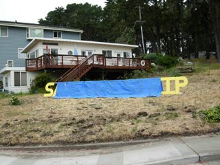
Beneath The Tarp: “Save The Strip”?

savethestrip.jpg

Oh, Lordy! Is the “Build-Up-The-Strip” plan back….?

Just imagine, passenger and commuter cars and work trucks on Highway 1, some of them veering off an already busy, clogged road to build a strip mall? Is this a vision for the Coastside’s future?

view1.jpgview2.jpg

Moss Beach Shrink Psychoanalyzes “The Coastsider” In 1980

In 1980 I interviewed Moss Beach psychiatrist Dr. Dorothy Zietz for “The Mystery of Half Moon Bay”. Her office was located in her home, a modern redwood house overlooking the sea.

Dr. Zietz arrived on the Coastside in 1959 and when I met her 20 years later, she said not much had changed.The Coastside was still relatively isolated, with many reminders of its rural past. The passage of Proposition 20 had limited development in the old Ocean Shore Railroad towns.

Most important, Dr. Zietz told me that the people hadn’t changed either. They were still “Coastsiders” as they once were.

“There’s no government here, no sense of community,” Dr. Zietz said. “No sense of neighborhood…Each small community is autonomous onto itself,” Dr. Zietz said, not complaining.

She added, again not complaining, that the “Board of Supervisors is not as aware of us as they might be. Things go on here that are not tolerated in Redwood City…We don’t want government interference, that’s what this country was based on….The old frrontierism is an attraction. On the Coastside there’s a chance to be free of things the urban person has to conform to…”

“Half Moon Bay and Pacifica are very different. Pacifica has a very identifiable government, their choice. We resist that in the true tradition of American spirit. We resist that. We don’t want a six-lane highway.”

“A highly socialized person could not exist here,” she told me. “There are no planned activities–that’s why we’re here…The person who chooses to stay does not need great contact with other people. There’s not much communication between people, nothing to join– yet there’s joining.”

In Dr. Zietz’s opinion, a society showed true maturity when the people could live without structure.

I’m Still Asking: Tell Me More About The Shuttle

And again I ask:

I don’t understand this story: tell me more about the shuttle. Is it crossing Devil’s Slide? Going from Montara directly to Pacifica? Will we be able to see what construction crews are doing? Can we keep our cars on the Pacifica side and get a free ride over the Slide to Half Moon Bay? What will the shuttle look like? Air conditioned for those hot summer days? Who are the drivers? Will you be hiring local drivers?

In the story, we are referred to a phone number that belongs to someone who does not live on the Coastside. Why is that? Wouldn’t Coastsiders be better served by someone who lives here and knows our problems?

Here’s the story from the SF Examiner

(From S.F. Examiner, June 16, 2006)

“County plans shuttle to, from coastside
July-September route meant to alleviate closure issues

Relief by way of shuttle is coming to San Mateo County coastal residents burdened by ongoing traffic snarls caused by the closure of state Highway 1 in April.

San Mateo County officials approved the use of $160,000 in emergency funds to help develop an emergency shuttle service for coastal residents.

State Highway 1 between Pacifica and Montara was closed April 2, after heavy rains caused a landslide that compromised the thoroughfare.

‘This shuttle service will enable commuters and students to travel to and from the coastside comunities that are both north and south of the Devil’s Slide closure,’ Pacifica Councilman Jim Vreeland said in a statement.

Parking Company of America will provide the shuttle service, and the Peninsula Traffic Congestion Relief Alliance and SamTrans will develop the shuttle route and schedule, whic is expected to begin in July.

‘While the shuttle service won’t alleviate much of the travel time needed for their commute, it will take some cars off the road and allow these residents to sit back and relax,’ Half Moon Bay Vice Mayor Naomi Patridge said.

Funding for the shuttle service will be provided through September, at which time the closed section of the highway is expected to open.

For more information on the emergency shuttle service, contact Christine Maley-Grubi of the Peninsula Traffic Congestion Relief Alliance at (650) 588-8170.”

A Short History Of The Ocean Shore Railroad (Part III)

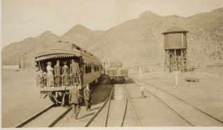
As told to me in 1980 by Randolph Brandt, whose father was an investor, a stockholder, in the Ocean Shore Railroad:

rr1.jpg

“One night they had some kind of convention or big picnic down near Granada—anyway, the train was heading back to the City with a whole bunch of people on it.

“And around Pt. Rockaway, a big boulder came down. Right on the tracks. The train saw it and they stopped but they couldn’t get the boulder off the tracks.

“The train crew decided to back the train to the Pedro Valley. And they backed it down there right in front of Danman’s Place—the old saloon there. They spent the night in there. Eatin’, drinkin’, making merry.

“I understand they practically cleaned the place out as far as booze and grub went.

“Relatives and friends were disturbed when the train never showed up in San Francisco. They sent a work train down, got the boulder off the track, got the train back to the city. It was 18 hours late, I guess it was a big deal.

“…Tunitas was the end of the line and there wasn’t much of a station there.

[referring to the railroad ride] “Those 20 miles there was hell on earth if you know what I mean. I mean it was really rough going. Anybody riding on it today would say, ‘Never again’. They probably never wanted to do it a second time.

“…the old county road, as far as going along the ocean—it didn’t even exist in those days. It was all in back of the hills, sort of sandwiched in between the mountains and the skyline. It wound and twisted, a narrow road with hardly a straight stretch in it.

“The railroad took up the entire area all the way from Westlake clear to Sharp Park. When they did put the highway in about 1934, they took over the entire railroad right-of-way in order to bring it to the edge of the cliffs. When you got down into Montara you were out of the cliff areas.

“In my opinion, it was a pretty lousy road, frankly. It would never do for these high speed cars today. Definitely not a road for high speed.â€?

A Short History Of The Ocean Shore Railroad (Part II): Read The DEJA VU

“There were landslides from time to time. The Pedro Pt/Devil’s Slide area was a particularly bad section. On one occasion, I think around 1915, as a result of some fairly torrential storms, about a mile-and-a-half or two miles of right-of-way track just suddenly dropped from right under and fell into the ocean…”

As told to me in 1980 by Randolph Brandt, whose father was an investor, a stockholder, in the Ocean Shore Railroad:

rbrandt.jpg
“In 1907 they got a train into Rockaway, no Vallemar. I think the first train rolled into Vallemar around 1907. They sent an engine down there with two coaches—and a load of people, a lot of promotion and activity.

“People were assured that this was going to be the new ‘Coney Island of the West’. All sorts of grandiose plans and promoters were springing up. And these communities along the way which were yet unnamed—were coming to life like Granada.

“…The depot in San Francisco was located at 12th & Mission Streets. …

“They even invited people to go down on weekends to give ‘em a free ride down there—and a free lunch—and then when you got off the train down there, all these salesmen were there busy. Sales slips, you know, sign on the dotted line to buy lots.

“They assured people the railroad would be finished within a year or two—and have wonderful rapid transit right into the heart of San Francisco. Business was so good for awhile that they didn’t have enough coaches so they dragged out a bunch of flat cars and put benches in them, you know, and people rode flat cars with benches down there.

“If any of you have eer driven in an open car along here [Devil’s Slide] when it’s pretty windy, you can imagine how some of the ladies must have felt having their hats blow off—and I don’t know what else especially when they’re going around Pedro Point and Devil’s Slide.

“It gets pretty windy—especially looking over the edge of a flat car and seeing the ocean down below on the edge of the cliff.â€?

Randolph Brandt smiled and laughed.

“Must have been quite an experience.

“There were landslides from time to time. The Pedro Pt/Devil’s Slide area was a particularly bad section. On one occasion, I think around 1915, as a result of some fairly torrential storms, about a mile-and-a-half or two miles of right-of-way track just suddenly dropped from right under and fell into the ocean.

“Luckily, there were no trains in the area at the time.

“It disrupted service for awhile. They ran trains as far as they could go to where the right-of-way caved off—enough space left, apparently, and then brought in a train from the south and passengers got off the train, walked along the edge of cliff ‘til they got to the other train—and then ran the train backwards all the way to Tunitas [south of Half Moon Bay]

“Another problem—the boulders came off the cliffs every once in a while onto the track….â€?

…To be continued…

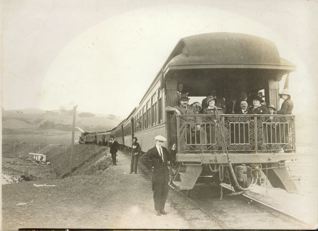
A Short History Of The Ocean Shore Railroad (Part I)

train.jpgA Short History Of The Ocean Shore Railroad (Part I)

As told to me in 1980 by Randolph Brandt, whose father was an investor, a stockholder, in the Ocean Shore Railroad:

“He, like a number of other people in the days when the stock was being offered to the public market, thought it was a good thing and it apparently was.

“There are a number of banks and prominent people—quite a number of people, well-heeled financially that invested money in it. Mr. Downey Harveyt there, was one of the original promoters of the line and he dropped, I think, around $2 million in it. Of course, he was one of those people that inherited the money, you know, didn’t have to work for it.

“And another man who was pretty well-off financially, too, was Mr. Foelder of the well known Foelger Coffee Company, and he dropped quite a bit of money into it—somewhere between a million and a million-and-a-half.

“In those days, a million was not considered pennies.

“When they got this thing started—it was just before the earthquake, well, 1905, well, railroads were springing up all over the place, up and down the state—from one end to the other they were starting to build…

“Why not a line down the coast to Santa Cruz?

“One of the reasons was tht they figured if they built the line through to Santa Cru they could take a lot of the business away from the SP [Southern Pacific], which had the monopoly up ‘til then by going the other way.

“Look like a good proposition. No one else was in there. They started work from both ends with one crew working from San Francisco south, another crew starting from Santa Cru, working north.

“Got along fine until a certain day in April 1906 when they had an earthquake. One of things they didn’t’ anticipate was a good deal of construction equipment, particularly in the area around Mussel Rock tumbled off the right-of-way and down into the ocean.

“A considerable financial loss.

“And part of the right-of-way, likewise, followed the equipment into the ocean—more financial loss—and additional expenditures the promoters hadn’t figured on.

“Recovered from that somehow and they pared down the project a bit as a result of that. One of the shortcomings of the original promoters was that they were a little too grandiose in their ideas. They started out—it was planned as a double-track electric, actually, to run from San Francisco to Santa Cruz, via Half Moon Bay.

“Better off if they’d started out with a single-track steam line. Then as business justified it, then extending to double-track, they might have succeeded. When you grade for a double-track along the line it actually costs you more than if you grade for a single track, so it means more money out. Since they never used the double track, well, it was just money wasted…”

Photo: Randolph Brandt

…To be continued…