This is where our adventure-seeking Coastside photographer Michael Powers was–stopping to visit with kids from a Masai tribe in eastern Kenya] on his way to climb Mt. Kilimanjaro in Tanzania.
Few people know that long ago I put on my carpenter clothes, brought my hammer down to Miramar Beach and helped nail some redwood shingles onto Michael’s famous geodesic dome. Incidentally, Michael told me, “I’m still looking for a creative spirit with fire in the belly to share our new studio… if you know of someone who might fit here, have them call me asap! 650- 726-2748.”
When I first landed on the Coastside, and became intrigued with local history, I met with Louie Miguel, whose father, Joseph, was one of the masterminds behind the spectacular Palace Miramar Hotel. Louie offered good background info and also talked about the US military taking over his father’s buildings during WWII.
[The military moved into many of the Coastside’s public buildings, and most certainly, those located on the beach side of the highway, as the Palace was.]
Below: To visit the âCalifornia State Militaryâ? website, click here
The former Camp Miramar was established on 21 April 1943 when the U.S. Army entered into leases with several land owners in order to provide for a camp to house infantry units assigned to the Western Defense Command. The 1 June 1943 edition of the Station List of the Army of the United States, issued by the Adjutant General of the U.S. Army, stated that a single rifle company, Company G of the 125th Infantry Regiment, was present at Camp Miramar.
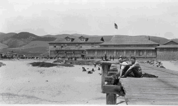
At the time of acquisition, there were two major buildings that the U.S. Army took control of. The first was the Miramar School, a small elementary school that served the local faming community and located on the eastern parcel, between State Highway 1 and Valencia Street. The other major building was the Palace Miramar Hotel and Resort, a large redwood-shingled building located on the beach in the western parcel of the Site.
To these substantial buildings, the U.S. Army added several temporary barracks, mess halls and support buildings. These were of the Civilian Conservation Corps (CCC) design developed by the U.S. Army Quartermaster Corps in the late 1930âs. These prefabricated, wood framed buildings could be assembled in as little as three hours by joining components with lag screws. Creosote soaked posts served as the foundation for these buildings. With the CCC buildings included, the post had a capacity to house 495 soldiers.
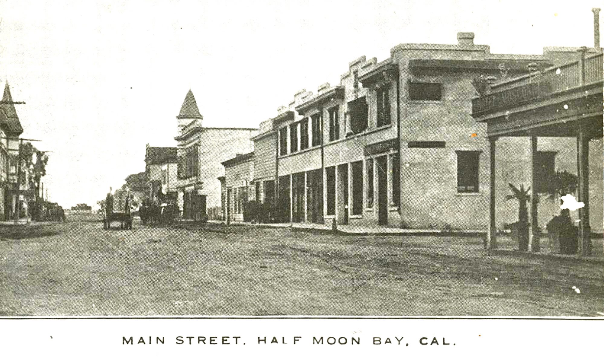
Palace Miramar Hotel and Beach Resort in the 1920âs (www.halfmoonbaymemories.com).
In a letter to the Adjutant General, U.S. Army; dated 23 January 1944, the Western Defense Command identified the Site as vacant and excess to its needs. On 11 May 1944, Office of the Chief of Engineers at the War Department approved a request from the Bureau of Yards and Docks of the Navy Department for the six of the barracks and one on the latrine buildings. This transfer of the buildings to the Point Montera Anti-Aircraft Training Center was made without the U.S. Navy becoming responsible for restoration the land on which the buildings were situated.
From September until December 1944, the U.S. Army terminated its leases for the Site. A 1946 aerial photograph does not show any of the CCC buildings remaining. On 6 May 1952, the U.S. Army terminated its permits for water and sewer lines that ran along State Highway 1.
I got this piece of Congressman Ron Paul political art via the human links of family & friends: Burt and I enjoyed Thanksgiving dinner at my cousin Gabriele Korn’s home “over the hill”, and with a sparkle in her eye, she said she had something for me. She handed me this postcard sized artist’s rendering of Congressman Paul’s likeness–produced by the locally based “Skyline Movement.” And how did she get it? From her chiropractor, Mark Reis, a great guy,who is also my chiropractor (but fortunately I haven’t had to see him recently.)
It’s not unusual to see similar political mailings but this one was not a photograph. This is a piece of genuine art that somebody labored over.
For those who don’t know anything about Congressman Paul, he’s running for President in the Republican primaries–and has stunned conventional political observers with the groundswell of support from people excited by Dr. Paul’s anti-war, pro-Constitution stance.
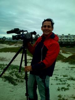
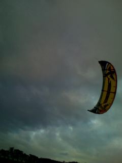
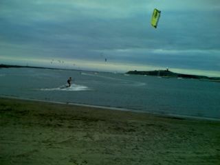
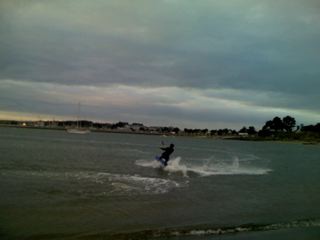
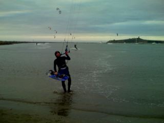
Only on rare days like today– when the gusty winds are blowing sideways, and the surly waves are whipping up a froth–do the kite surfers come to our shores….and they were here today where I encountered Luis, a Brazilian filmmaker.
(Photo: Brazilian filmmaker Luis…The pix below are mine and I wish Luis would send me his!)
Luis was making a film about the kite-surfers–some of them his friends. These were not ordinary kite-surfers–they were professionals athletes being swept by the winds 30 feet into the air, making elegant sharp turns (like professional ice skaters) in the surf. At one point there were at least a dozen of these giant, colorful kites in the air.
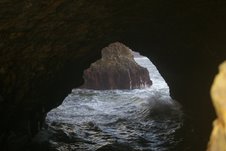
(Photos: Upper right, Arch Rock. At left: Shot from the clifftops about a half mile north of the Scott Beach bridge. Courtesy John Vonderlin.)
Hi June,
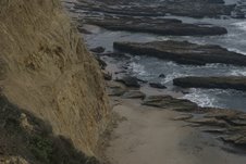
I was in a quandary, as to which, of the myriad of metaphors for lack of early success to use, to describe my second attempt to reach “Acid Beach.”
Anything worth having is worth working for,” was a contender, but since in my mind, work is being paid for doing things you don’t want to do, that metaphor didn’t seem right. After considering a handful of others, I settled on the accurately descriptive, but not future predictive,
“So Close, Yet So Far.”
(Photo: ) So Close, Yet So Far” shot from my turnaround spot, Chicken’s Roost. Courtesy John Vonderlin.)
And I was close, like a prisoner staring out at freedom from his cell’s barred window.
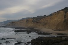
After a mile- and- half of beach walking, clambering over numerous algae-slickened rocks, splashing through shallow water between waves in a number of spots, losing Meg, my quest partner’s companionship, at one treacherous spot, requiring me to crush a number of barnacles and mussels while sidling along the cliff to keep from swimming, a stomach-scraping to-my-limit muscle-up from a slippery toehold onto a sheer 8 foot wall’s top, and finally hand and toe-holding my way up a 20 foot cliff to the top of a promontory projecting into deep water, I was stopped.
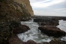
(Photo: That’s Meg waving good-bye at her turnback spot. I was able to clamber along the slimy cliff along the path indicated by the white dots thanks to the traction barnacles and mussels provided. Sorry guys, I know your life is tough enough as it is. Courtesy John Vonderlin.)
Oh, I probably could have inched along the slimy, narrow, littered with scree ledge under the cliff, rising above me without falling into the unknown depths of the surf waiting below. But, I wasn’t sure I could climb back up when I returned.
Staring at my route forward I was assaulted by other doubts. Could I protect my camera during a fall? Or, after landing in the steep-sided inlet roiling with surging waves? And what about the two other tough spots ahead, still between me and my destination, that I had judged the most impassable when looking at the large photo files on California Coastal Records Project website?
Would descending from the cliff I was standing on just put me between a rock and a hard spot? What if I injured myself? Meg would never get past the muscle-up spot or on top of this cliff I was vacillating on, even if she finally got worried enough when I didn’t return and managed to traverse the area that had stopped her a quarter mile back.
Artist Michael Bowen, who lived at Tunitas Creek and hung out at the Abalone Factory in Princeton, brought this colorful incident to my attention and I want to share it with you.
“The hippies wanted to believe this desperately. But what was Kesey doing putting down LSD in the pages of the Chronicle? And what did he mean when he talked about going beyond acid? Give it up altogether? That was the Establishment’s line and the Establishment had Kesey by the proverbial testicles, what with three felony counts. The Haight hummed with speculation, much of it paranoid. According to the leading paranoiacs, Kesey’s public statements were just a smoke-screen. What he was planning was a monster Acid Test, the biggeest and most powerful one ever, the gorup mind pushed to its omega point. And either the State would shatter or…There was always a long pause as the implications of that sank in. Everyone had heard rumors that the Acid Test had turned fascistic down in L.A. And hadn’t Kesey actually said on TV, when asked what his main message for the graduating acidheads would be, hadn’t he quipped: “Never trust a Prankster!” (9) What kind of a valedictory was that?
John Vonderlin sent me this info about Tom Wolfe’s “Electric Kool-Aid Acid Test” moving from words in a book to images on the screen. Former La Honda author Ken Kesey & the Merry Pranksters are the main characters in Wolfe’s book.
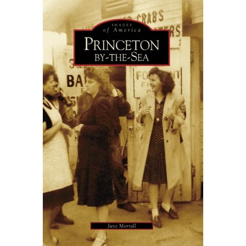
What it made me think about was this: In the late 1950s some unusual and talented Beatniks were run out of their homes around the cafes in San Francisco’s North Beach and headed south where they found a temporary haven at our Princeton, north of Half Moon Bay. There’s a chapter on this in my new book, “Princeton-by-the-Sea,” due to be published by Arcadia on Dec. 10.
The story of the Beatniks, including the famous artist Michael Bowen, who lived at the Abalone Factory in Princeton, is a little known and juicy slice of local history– and I am very proud to have resurrected it, prompted by long ago interviews with Pete Douglas of the Bach Dancing & Dynamite Society in Miramar. (Pete’s also in my new book.)
What’s interesting is that these Beats who were in-your-face types, that were harassed by the cops and others, and protested on the spot–also overlapped the period that Ken Kesey was driving his day-glo painted school bus through the redwoods of La Honda.
But guess what? They didn’t get along, the Beats & Kesey. Not only a little generation gap but here’s my ice cream analogy: If the Beats were double chocolate fudge, Ken Kesey & the Merry Pranksters were definitely vanilla.
I hope Movie Director Gus Van Sant explores that in his new movie.
As I mentioned in an earlier email, a large portion of the non-buoyant marine debris I collect from Neptune’s Vomitorium, comes from the various fishing industries that ply our local coastal waters. In this portion are the majority of items that pose the greatest dangers to various lifeforms that inhabit the coastal areas as well as unwary beachwalkers.
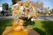
But, because of their great number and astounding variety I’m happy that they have provided me with the raw materials for a sizable number of pieces of artplay. I’ve attached a few pictures of pieces from my series entitled: “Neptune’s Burden: The Ones That Got Away.”
The first two photos are of the original “Neptune’s Burden.”
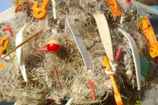
It’s a work in progress, as I have a large number of small bits of lost fishing gear (hooks, swivels, leaders, etc.) to cut out of the three trash cans full of fishing line balls that I still must process and add to the World’s Largest Fishing Line Ball.
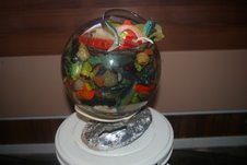
The third photo is a naturally-polished abalone shell
topped by a part of a plastic buoy in which the glass sphere full of colorful rubber fish lure remnants rests.
The last photo is of a fishing pole’s broken remnants entangled with other balls of line and a piece of cloth. I had to do almost nothing to this.
In fact, my beachcombing partner assumed it was a fisherfolk’s homemade grave marker that had washed away when she first saw it. It isn’t, but its appearance and the proportions of its remnants dictated its use in my mind. If you look closely you can see the eyelets that guide the line on a fishing pole entangled in the mess. The mourners are composed of a pareidolic rock and marine debris pieces. Enjoy. John Vonderlin
When I first moved to El Granada, I couldn’t help but notice that some of the median strips–especially the one near El Granada Market–were filled with flowers. A sign told me that the flowers had been planted and were maintained by the El Granada Garden Club.
Garden Club members planted colorful flowers and also pine trees–Daniel Burnham style– (if you don’t know who Mr. Burnham was–he was the renowned architect who, during the Ocean Shore Railroad era, developed the unique street plan for El Granada, you know, the one you can get lost in– and, who, intended that there be vast plots of flowers and trees planted along the broad avenues.)
In the early 1900s, flowers and trees were planted as Burnham indicated in his beautiful plan. But after the Ocean Shore went bust so did Coastside real estate, and, well, there was nobody around to do the gardening.
Being a great lover of flowers and gardens, I can’t help but wonder who was going to water all those plants and trees? Who would pay for the watering? What would happen if there was a drought? Had the Ocean Shore thought it through?
Most of all, I am wondering what happened to the El Granada Garden Club….
“These communities were established on the Mid-Coast between 1906 and 1909 during the real estate boom that followed the construction of the Ocean Shore Railroad. Speculators quickly subdivided the lands along the new rail line, expecting a real estate boom to follow in its tracks. This never took place. Few of the subdivided lots were developed during the first half of this century.
“By 1950, the Mid-Coast population was only 1,700 residents. During the next two decades, however, the population more than doubled to 4,000.
“As buildable land on the Bayside disappeared, many contractors discovered the abundance of vacant subdivided lots in the community. A small building boom resulted and by 1979 over 6,500 persons resided in the area.