Story by John Vonderlin
Email John ([email protected])
Hi June,
While I was researching the next of the early Coast Survey maps I wanted to post about, that being the Half Moon Bay one, it occurred to me there must be some much earlier, cruder maps showing the Coastside, then the meticulously documented ones the Coast Survey created. The Library of Congress had a few interesting ones I’d like to share.
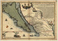
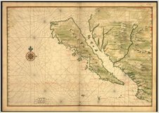
The most unusual thing about the early maps was they showed California as an island. Based on inaccurate Spanish accounts, European cartographers had begun in 1622 to portray the western coast of North America as a seperate island. The British and Dutch accepted this misconception well into the 18th century, long after Father Eusebio Kino confirmed during explorations of the American southwest from 1698 to 1701 that California was not an island.
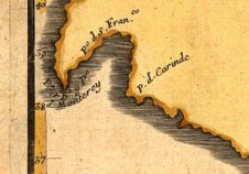
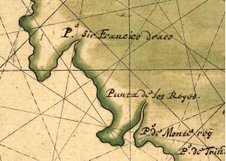
This first map, published by Joan Vinckeboone, a Flemish cartographer, in 1650, illustrates that. I’ve attached a close-up of the Coastside from this map, though it is recognizable only by its relationship to Monterey and Point Reyes.
The next map is from 1720 and it’s not much better, though as you can see the details in the Mexican mainland are much improved. This was created by Nicolas De Fer, a French cartographer. The close-up of the Coastside and surrounding area is even less recognizable in this one.
The quality of these maps, as far as portraying our area accurately, gives us a good idea why Portola, in 1769, found it so hard to find Monterey, and passing it by, eventualy making the serendipitous discovery of the San Francisco Bay. Enjoy. John
