âDown the Ocean Shoreâ?*âFrom “San Francisco: A Chapter in Your Life”, a pamphlet encouraging people to visit California after WWII, published by Californians, Inc, 1946. I inserted the photos by R. Guy Smith.
(âS1â? = Highway 1âautomobile tour begins near Sharp Park, Pacifica, then proceeds south to Half Moon Bay and Pescadero).
.â? â¦On S1 you follow in reverse the way of the Portola expedition up coast in 1769, expedition that discovered San Francisco Bay, led to settlement of San Francisco in 1776.
“Near mouth of San Pedro Creek, 8.1 m, guarded by lofty San Pedro Point, Portola expedition camped by an Indian village Oct. 31, feasted on mussels pried from rocks. Portola sent Sgt. Ortega with party to scout eastward. As they climbed to top of ridge they saw vast expanse of San Francisco Bay, never before seen by white men. Here, in Pedro Valley, begin fields of silver-green artichokes which supply bulk of this delicacy for nation.
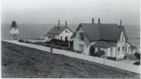
(Photo at right): Montara Lighthouse
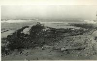
“Montara, 12.3m, with its Lighthouse, U.S. Navy Radio Compass Station and U.S. Navy Anti-Aircraft Gunnery School, is a land checkered with fields that supply as many as 20,000,000 blossoms of everlasting flowers annually. Coast from this point on is said to closely resemble that of Bay of Biscay. Off-shore from cluster of houses that makes Moss Beach, 13.6m, are strangely beautiful marine gardens.”
(Photo at left): anti-aircraft gunnery school
(Photo at right): “Marine” gardens at Moss Beach
…to be continued…

