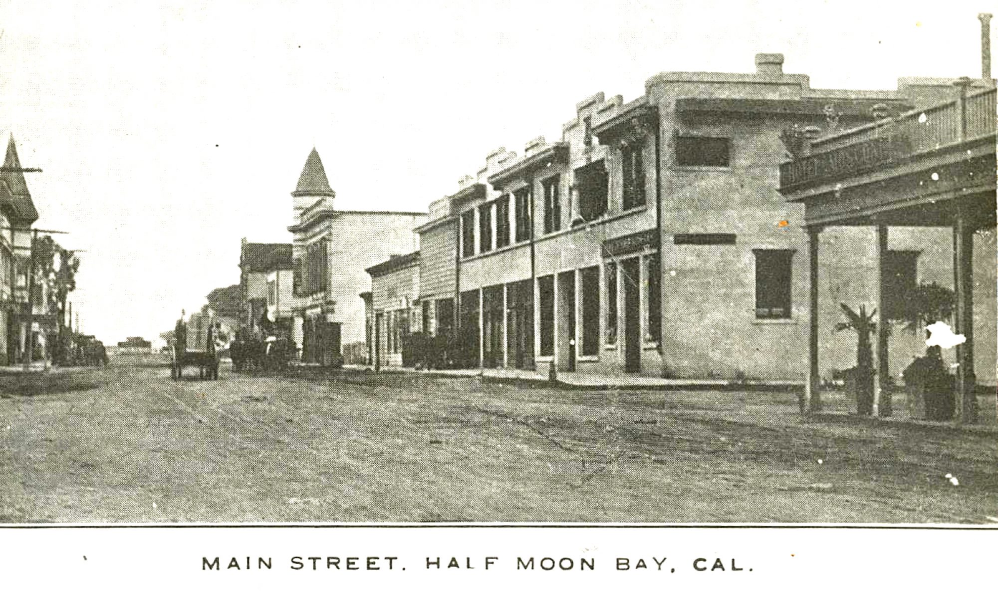
Three decades after the Ocean Shore Railroad declared bankruptcy and pulled out of the Coastside, the train’s right-of-way was paved over with a new road, eventually called Hwy 1. The paving occured in stages up and down the Coastisde, between the 1940s and 50s.
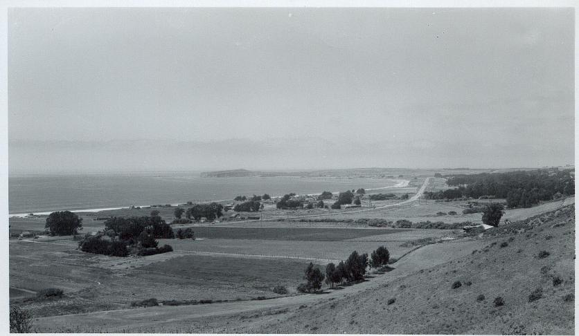
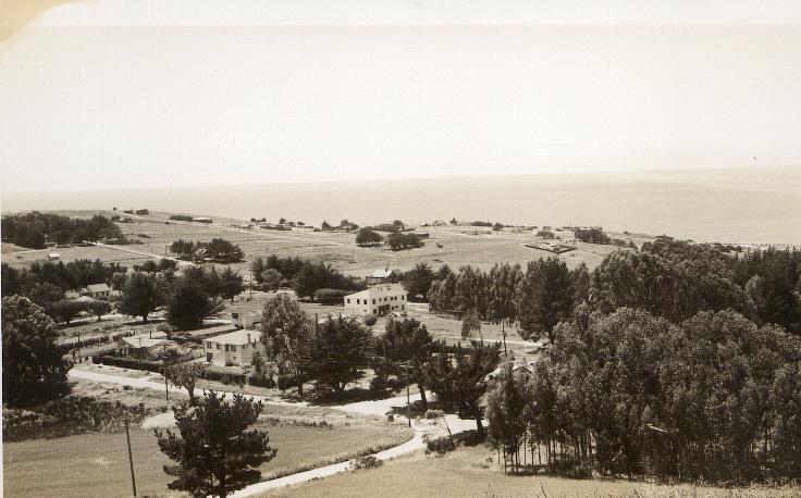
This R. Guy Smith photo could have been taken in the early 1950s–when development was taking place on “the other side of the hill” but not on the Coastside, still wide open. In this picture it seems the Ocean Shore left us little to remember it with. But if you look closely some landmarks are visible such as the old Amesport Pier (1860s, rebuilt 1916) at Miramar. That’s Pillar Point to the north.
Notice there’s no traffic? What’d they do, close the highway so the photographer, R. Guy Smith, could get the shot? Nice.
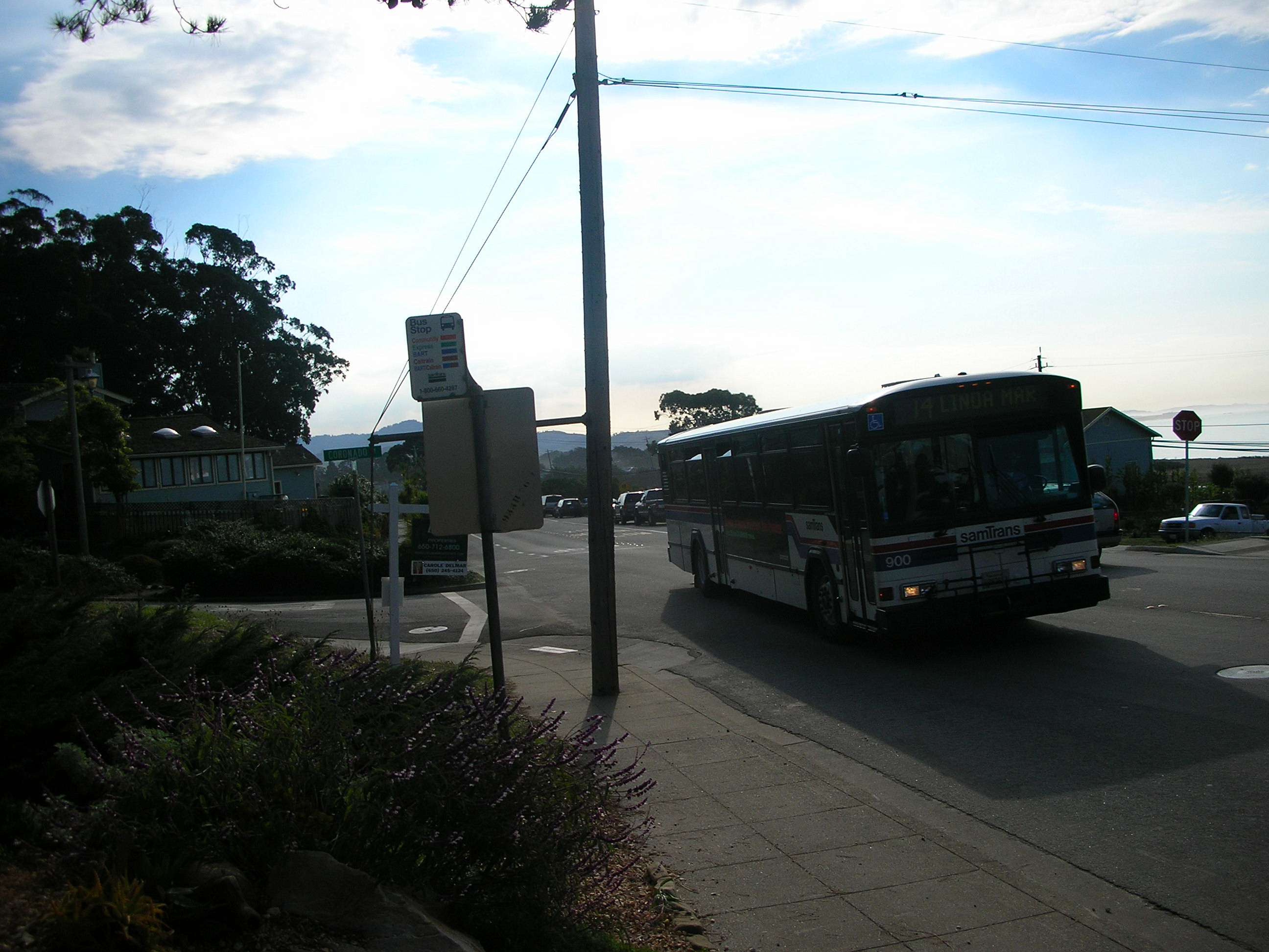
The bus stops at Coronado and Plaza Alhambra in El Granada, across the street from the Wilkinson School and a couple of blocks from the El Granada school. There’s no crosswalk anywhere so if you cross the street when the big bus, with the right-of-way, is coming, headed for the bus stop, you’re in big trouble. You could run, but….
There’s another much safer bus stop a couple of blocks down the street.
I decided to type the document called “Organization of the Moss Beach Chamber of Commerce was announced today.” (February 12, 1952).
In my previous post, you can click on the original and read it, too.
This is the baby chamber of commerce of California, but its Secretary-Manager R. Guy Smith is the senior member of the Central and Northern California Chamber of Commerce Executives organization. His membership dates fromm 1925 when he was secretary of the old Coastside Civic Union which promoted the formation of Joint Highway DistrictNo. 9 which is composed of the counties of San Francisco, San Mateo and Santa Cruz. It was formed for the purpose of building along the ocean that portion of State Highway No. 1 from San Francisco to Santa Cruz.
The first problem now confronting the new chamber is the permanent improvement of this popular highway at Pedro Mountain.
Earth and rock slides have interrupted traffic each winter since its first opening in 1937, fourteen years ago.
The chamber advocates two practical solutions to this problem.
The first solution would be an elevated four lane causeway across the face of Pedro Mountain at the present location. Built high enough to permit all slides of earth and rock to pass beneath it. Supporting elements would be heavy and strong enough to resist the crash force of the heaviest boulders that would be likely to strike it. Foundation of the supporting elements, or piers of the causeway would be upon solid granite rock.
The second solution would be a four lane tunnel located either at Green Canyon, or at the canyon immediately to the south. This tunnel would be about 2800 feet long and approximately 500 feet above sea level. It would shorted the present road by one mile and cost approximately $500,000,00. This is the opinion of an engineer who is thoroughly familiar with this road.
A tunnel at this point would be entirely through solid granite rock, emerging on the north side of the mountain above the stratified rock formation which is responsible for the slides that are now causing trouble.
This work would be done under the TEN YEAR COLLIER PLAN of 1947 which calls for a four lane highway along the coast from San Francisco to the junction with the San Mateo road, a distance of 30 miles.
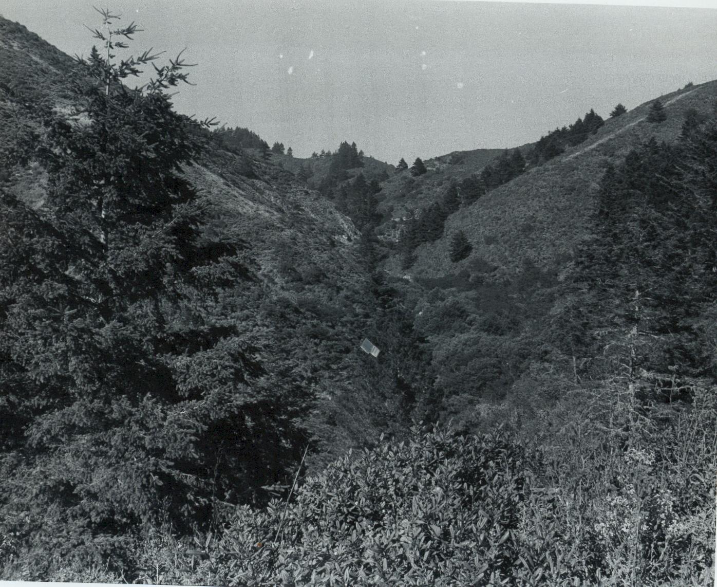
I got to know the Coastside Comet Editor George E. Dunn’s son, also called George Dunn–and he was retired when I met him and he had been a newspaper man, too–and he insisted I have this photograph of Ox Mountain, because, he said, this is what that beautiful place looked like before it became a county wide refuse dump off Highway 92, a couple of miles east of the town of Half Moon Bay.
Locals talking, worriedly, about friends being rear-ended on Highway 1. “It’s happening all the time,” one woman said.
My boyfriend’s car was rear-ended two weeks ago at 8:15 a.m. near Miramar. Popped and broke the trunk lock and scared him– no wonder, his small car was struck by a monster SUV.
He called me and I ran down to make sure everything was okay. On the ground I found this small jagged piece of gray plastic. I picked it up only because I thought it was part of our car’s bumper or something–. I was holding the useless piece of plastic when the young man who hit my friend’s car (the kid must have been in “shock”) took the plastic from me, thanking me over and over as if it was worth a million dollars–by the way the house across the street sold in one week for $1.2 (see earlier post).
I have often dreamed of closing Highwy 1 between Princeton and Miramar, leaving the foot and bike paths–but we need access–something to work on. It seems like a good idea to close the automobile road between those two points.
There’s lots of talk these days about two “hot” and scary topics: an earthquake that turns San Francisco into the “temporary city” and a super-flu that makes the 1918 pandemic look like the common cold. And there are many books to choose from about these horrific possibilities, among the latest “A Crack in the Edge of the Earth:America and the Great California Earthquake of 1906” by Simon Winchester (about the freakishness of geology that I’m currently devouring) and “The Great Influenza: The Epic Story of the Deadliest Plague in History” by John M. Barry which I will read next.
In these strange times echoing with uncertainty on all sides, these non-fiction books seem like good old Stephen Kingish horror stories.
Many years ago I had already read “America’s Forgotten Pandemic: The Influenza of 1918” by Alfred Crosby which I highly recommend. In addition I read author Katherine Anne Porter’s personal account of how she survived the 1918 pandemic in her short story, “Pale Horse, Pale Rider”. Ms. Porter was in such fear that she wouldn’t allow herself to drift off into sleep–she had convinced herself she wouldn’t wake up if she closed her eyes.
Figures on deaths worldwide from this fast-moving flu have increased from what I initially read was about 22 million to 50 to 100 million. And now there are reports that the flu was a bird flu.
The San Mateo County Coastside, reeling from the failure of the Ocean Shore Railroad to open up this isolated, gorgeous stretch of artichokes and lonely beaches, became a health- haven for San Franciscans fleeing the deadly influenza in 1918. But the Coastside didn’t escape the flu–the community, widely spread between farms, bungalos serving as vacation homes for railroad commuters, and a couple of tiny agricultural towns, didn’t escape the deaths and because of the close-knitness of the people, these losses were keenly felt.
In 1918 ( just as in 1906 when some earthquake- fearing city folks, fled to the Coastside where they hoped the ground wouldn’t shake beneath their feet) entire families sought safety on the Coastside. Hard-to-rent Ocean Shore RR-era cottages became homes again in a previously lackluster real estate market.
The Coastside was sparsely populated, thought to be a perfect place to flee from the killer 1918 flu.
Just as people rushed into the Coastside, some rushed out. Miss Irmagarde Hazard, a teacher at the Montara School, packed her bags and left for San Luis Obispo, hoping she would outrun the worldwide epidemic.
The killer flu struck the Coastside in mid-September. Two important members of the community fell ill, the rural postal delivery man and a Catholic priest.