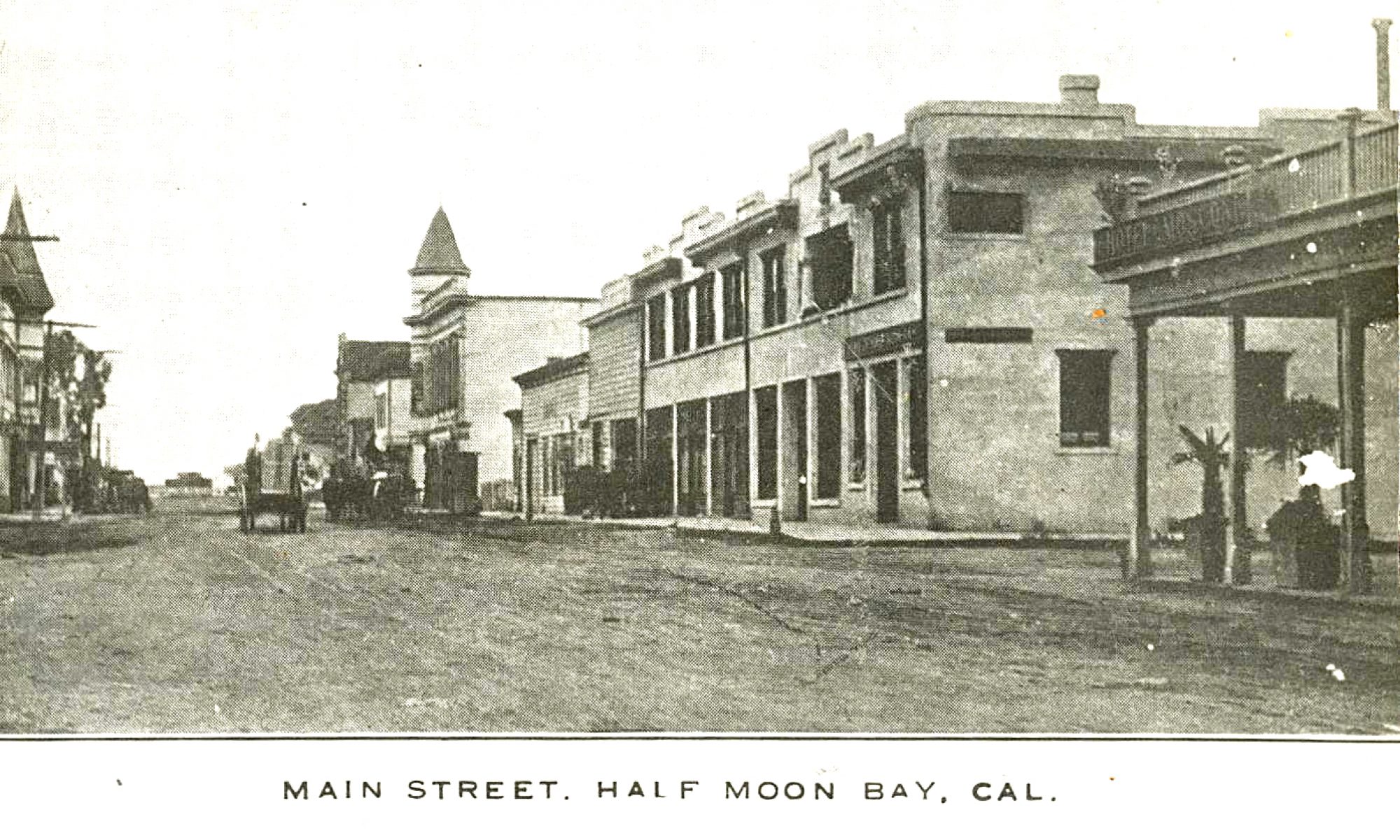
“…It is strange that nothing has ever been said about Half Moon Bay and the country around it; it is bounded by a large body of beautiful land, and I am informed the land is very rich and fertile. I saw large herds of cattle grazing on the plains and some indications of farming. This will certainly be a place of some importance in a few years…”
St. Matthew’s Land by Coastside artist Galen Wolf (Part II)

“St. Matthew’s Land,” Part II by Coastside Artist Galen Wolf
On the riders’ left hand rose the blue and misty ridge of a wooded range. Beyond the ridge lay the sea.
The salt smell of marshes and the glint of a great bay was to their right. Brown frocked Franciscan brothers rode the mules. Ragged and patch Indians accompanied them.
The cavalcade camped at the creek of San Francisquito, and again at a stream that emerged from low hills and flowed through the present San Mateo. They passed on to the founding of Dolores Mission.
It was a peninsula over which the riders travelled. It had the joy and excitement that waters bring to a land.
No one could forget that across the world wide sea lay the Tropic Isles, China and Japan. In its deeps lived huge whale and myriads of fish. Men lived here that set forth to sea for adventure and livelihood.
Captains built high white houses. Fishermen assembled huts of beach drift.
Hills ran like a spine the length of this land. They were blue with forest and with haze. In the midst of a taming land they remained wild. With their deer, bear and panther, their turbulent lumber camps, with creeks cool in fern choked canyons, they were a remote island between two growing populations.
…to be continued…
HMB Family
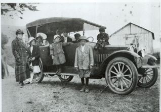 (Photo courtesy Bill Claudino)
St. Matthew’s Land by Coastside artist Galen Wolf (Part I)
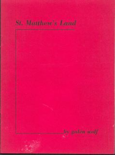
“St. Matthew’s Land” by Coastside artist Galen Wolfe written to accompany a series of paintings of Peninsula landmarks on display at the San Mateo Library in 1961.
Part I
St. Matthew’s land is San Mateo County.
A county is more than a political subdivision, more than its acres and population and improvements.
It is always, and foremost, a great human story. The eventful lives of its people, the legends and traditions, make the tale, make the rich personality of this land.
Unlike the Sierra, San Mateo County had no gold and little traffic in six guns. [I have never heard of this term, “six guns.” Anyone know?] But to offset the brash and rowdy thrill of this hectic and short-lived world, our county has a history more than twice as long. And far more varied.
It roughly divides into two parts, each looking over a century. The first was passed in the tranquil sleep of the Spaniard. The second awoke to the accelerating pace of an American state.
Years before the shots at Lexington were fired, the tiny hooves of mules were trudging ankle deep in the alluvial dust of the peninsula. They tinkled in the stony dry creek beds.
El Camino Real was being etched by these patient hooves, a road that was to be the ribbon of life in California for a hundred years. And in the county which became, for another hundred years. Amid changes inconceivable to the humble cavalcade of its beginning.
…to be continued…
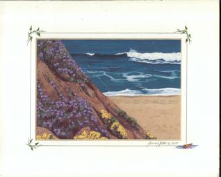
She’s Really Good…
I’m talking about Half Moon Bay artist January Hooker. Enjoy this wonderful “ocean view” piece:
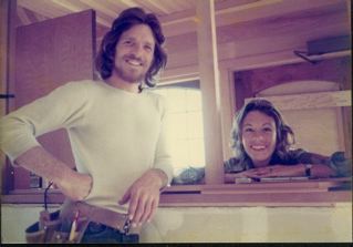 (Photo: Half Moon Bay artist January Hooker, at right, with husband Chad–picture taken when the Miramar Beach Inn was being remodeled in the late 1970s).
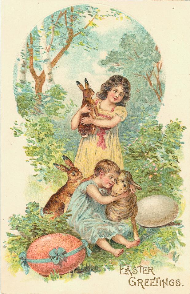
Happy Easter
(from “Dar” and friends). Click to enlarge.
Fitzgerald Marine Reserve Newsletter Features Story About Charlie Nye
pix that I took of “The Reef’s” Charlie Nye, a pix of me in front of Nye’s Reefs and lots more. Please check it out!
Cleaning House…And these are the books I haven’t sorted yet…
It’s so hard to get rid of stuff…How do you de-tach yourself from books you’ve had forever? In a way, they are like ex-lovers….I guess you just gotta be tough….

Things Change
 (Photo: Cunha’s Country Grocery on Main Street in the background, the location of a woman dentist’s office. There’s some interesting trim on the building, too; never noticed that before.)
Dear June
June
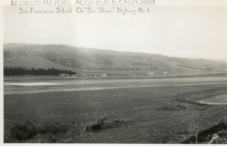
Thanks for all the info re the HMB area. I spent many hours roaming the
airport grounds as a kid. You may not be aware that the airport was
often used as an alternate to SF Intl when SF Intl was fogged in. It
was quite an event to see a DC-6 or DC-7 land on that very short runway.
Some of the airlines kept equipment at the airport to handle passengers
when needed.
There were a number of old buildings that were left over from the WW 2
period. They were abandoned and I used to wander through them. They
were at the North end of the airport just off the hwy.
We used to buy produce from japanese farmers who farmed the many little
canyons. Strawberries were a very popular purchase.
We lived in SF in the Castro Street area and every weekend we’d drive to HMB
so my Dad could work on his airplane. He was rebuilding one in a little
shack at the south end of the airport. I hated the ride down Devils
Slide! It really scared me as a kid. I was always greatly relieved
after we passed it.
My dad spent a great deal of time working on the rebuilding of his
plane. He manually rebuilt the wings. The fusilage of the airplane was
kept outside waiting for him to complete the wings. One day, the
airport management decided to do a controlled burn of the weeds and
accidentally burned up his fusilage! He was heartbroken! He was able
to sell the beautiful wings to another guy who came to pick them up in
his truck. Just as he was pulling out on to the hwy, he was broadsided
by another car! The wings were totally destroyed. I guess they were
never meant to fly.
The airport was managed by a Frank Sylvestri. He operated a maintenance
facility too.
I find it hard to believe that the area is so built up now. Having a
Ritz Carlton there really blows my mind! I always thought the weather
was terrible…it always seemed cold and overcast.
John Flynn
Downers Grove, Illinois