John Vonderlin: 1887: “Mammoth Reservoirs”

Story from John Vonderlin

Email John: [email protected]

mr1mr

Hi June,
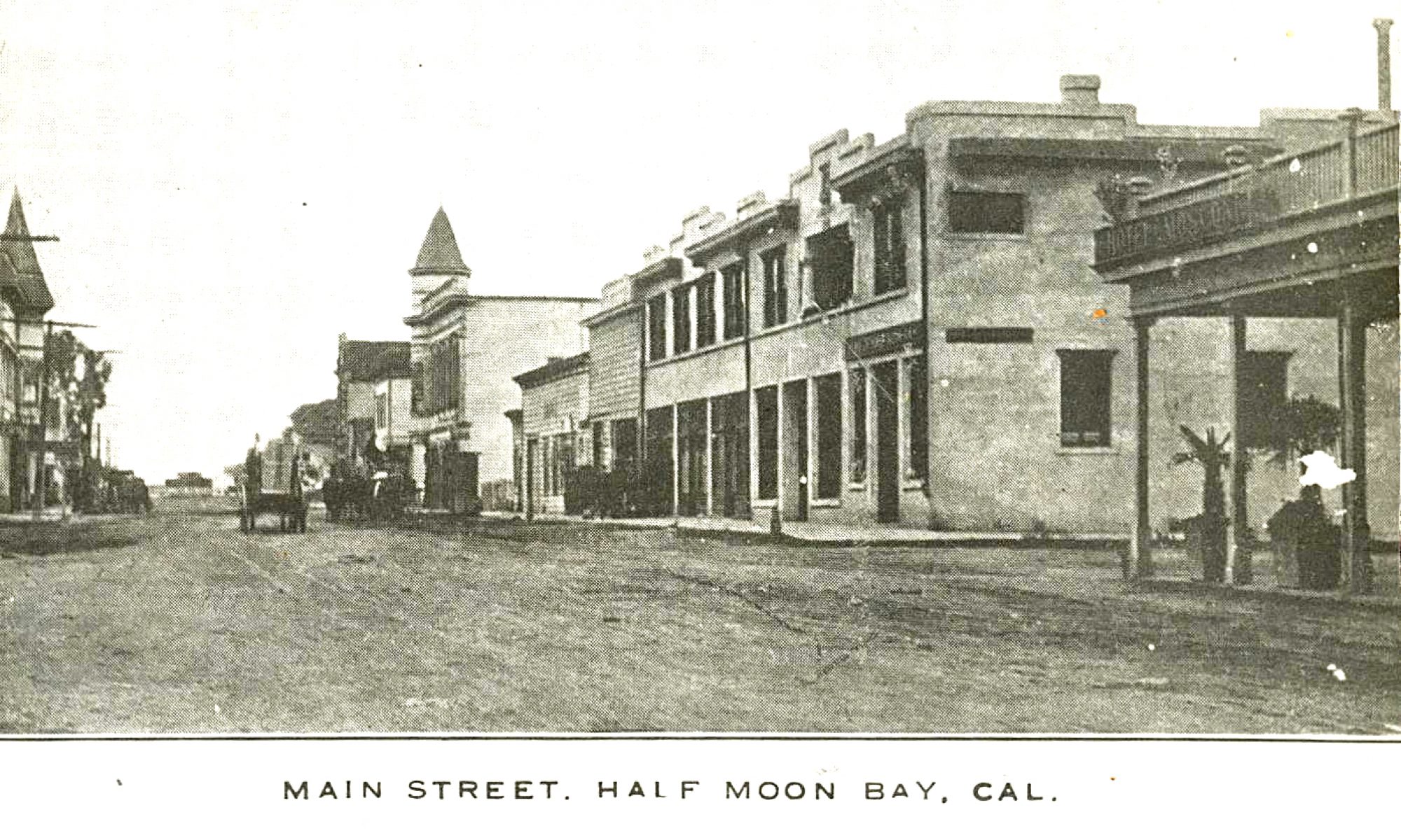
After reading this article, “Mammoth Reservoirs,” from the June 30th, 1887 issue of “The Daily Alta,” I did a little research on the Coastside’s water system. The map I’ve attached is from the Coastside County Water District’s website at www.coastsidewater.org I was amazed to read in the newspaper article that the Lower Crystal Springs Reservoir’s dam and its impoundment was the largest in the world at one time. I would guess the residents of Half Moon Bay at that time were proud of that fact and very happy to be relieved of the flooding Pilarcitos Creek must have caused. Enjoy. John
“There are not many prettier drives in the county of San Mateo, in fact in the State, then those to the different reservoirs of the Spring Valley Water Works. The road generally used starts in San Mateo and leads westerly  through the San Mateo Canyon. For its entire length large oaks overhanging the road add very much to its beauty, as well as shade. The San Mateo creek runs along  with an occasional ripple beside the road.
“Three miles or so bring us to the site of the proposed Lower Crystal Springs Dam reservoir, situate at the mouth of the San Mateo Canyon, a little below the junction
of the Canada Raymundo and San Mateo creeks. The work on this structure has already begun. There are about one hundred and twenty men employed preparing the foundation, which is already down a depth of ten feet and it is intended to go about ten feet further into the bedrock. This dam will be when completed 565 feet long on top and 170 feet high; it will have a width of 30 feet on top and a width of 175 feet on the bottom. It is to be built of stone, and will contain about 100,000 cubic yards. It will take about two years to complete it, and when finished it will be the largest dam in the world. The Quaker dam in New York when completed will be somewhat larger, but it will not have a storage capacity equal to that of the one now in course of construction by the Spring Valley Company.
“The presence of tunnels in the surrounding country resembles somewhat that of a mining camp. These tunnels were drifted in prospecting for bedrock or a suitable foundation for the dam, which it will be remembered, the company have spent several months in doing. The most suitable place found is the present site, where bedrock was struck within ten feet of the surface. When the dam is completed it will form a lake nine miles long and on an average a mile wide. When full it will contain about 32,150,000,000 gallons of water, and will equal very nearly twice the capacity of all the other reservoirs put together. The stone for this dam is to be taken from a quarry in the San Mateo Canyon about a. mile northwest from the dam-site, where a large quantity of desirable rock has been found after a great deal of prospecting. This reservoir will be the crowning work of the company in this county, and will insure San Francisco against all dangers of a water famine for a great many years to come.
“There are quite a number of men at work at present clearing the trees and brush from below the high-water mark, the brush being burnt and the wood piled in convenient places for burning bricks, of which the company will require a great many thousands in the completion of an outlet-tunnel for the reservoir, which will be ten feet in diameter and about five hundred feet long, passing under the hill on the north side of the dam. But a much larger amount of brick will be used for the completion of a tunnel from Woodside to the present Crystal Springs Lake, a distance of about five miles. This tunnel also will be ten feet in diameter and intended to carry the waters of the Bear Gulch and San Francisquito Creeks into the proposed reservoir. The work on this tunnel has already been begun, and is expected to be completed shortly alter the dam is finished.
Leaving the San Mateo Canyon and passing up the Canada Raymundo, for a distance of about two miles, brings us to the Upper Crystal Springs reservoir. The water of this reservoir supplies the lower portion of San Francisco, and is connected with the same by a 44-inch pipe. The Upper Crystal Springs reservoir is about three miles long and half a mile wide, and contains about 3,500,000.000 gallons. It is larger in area than any of the others, but is less deep. The dam is completed only to a height of fifty feet. Not having a foundation suitable for a dam much higher, it remains in its uncompleted state. When the lower dam is finished its waters will overflow the . upper reservoir by about thirty feet, thus doing away with it.
“To reach San Andreas reservoir the road must be retraced as far as the San Mateo Canyon, where it branches off up the San Andreas Valley. A little further on brings us to the San Mateo reservoir, which formerly supplied the town of San Mateo, now drawing from Crystal Springs. Continuing up the valley for a distance of about four miles, through a very dense growth of underbrush and willow brings us to the San Andreas reservoir. The waters of this  reservoir supply the middle portions of the city by a thirty-inch pipe. The reservoir is about three miles long and has a capacity of about 7,000,000,000 gallons. The watershed of this reservoir being small it derives its main supply from the coast side of the mountains, several streams being conducted to the reservoir by a series of tunnels, pipes and flumes. The road to Pilarcitos leads at once into underbrush.  It passes  through wild lilac, buckeye and many variety of smaller trees. On nearing the top it gets above the growth of trees and the eye catches a glimpse of the bay from its most southern point to the city, making one of the prettiest views on this peninsula. To the north the eye catches a glimpse of the Pacific Ocean,  just outside of the Golden Gate. On a clear day may be seen the steamers crossing from Oakland to San Francisco, also the towns of San Mateo, Redwood and Menlo Park.
“After passing over two ranges of mountains, a distance of about five miles, it brings us to the upper end of Pilarcitos Lake. This body of water, although the  smallest, is the most beautiful. A noble rocky point separates it into two arms, with Spring Valley Creek for a feeder on tbe east and the Pilarcitos Creek on the west. Unlike the hills around San Andreas and Crystal Springs, those of Pilarcitos bear fine specimens of fir and laurel. . The capacity of Pilarcitos reservoir is 1,080,000,000 gallons. It is connected with the city by a thirty-inch pipe. Having a higher elevation than any of the others, it supplies the  higher portions of tbe city. Leaving Lake Pilarcitos we  drive along a  road just wide enough  for a team, lined on either side with a variety of trees and smaller brush, from the gigantic fir to the smaller willow and wild  laurel;  along the  course of  a  small stream whose crystal  waters  add another charm to the  almost unsurpassed beauty of the surroundings.  After a drive of two miles through this forest of loveliness, we reach a clearing  where the steams  must be abandoned.  From the clearing a narrow path, still following  the windings of the Pilarcitos creek, leads for half a mile further into the depths of the forest. A sudden turn brings to view a miniature lake where the waters of the Pilarcitos creek are confined in a space so narrow that  a  stone can be thrown across it at any point.  Large trees, overhang  it on  every side; its waters, clear as crystal,  mirror all surrounding  objects.  Large trout may be seen leaping from its waters, flashing in the sunlight and disappearing from view in  an  instant. At one  end the waters from a narrow flume pour into it with unceasing flow. While standing on the dam, one might think the natural beauties of the scene could not be improved upon, but crossing the dam and following a small side flume, used as a feeder,  at  every step  new beauties are discovered. On one side of this flume is the ravine eighty or one  hundred feet deep,  the bottom and sides being  lined with granite boulders, along which a  small, but beautiful stream of water  slowly runs, now in sunlight, now in shadow, the murmur of which reaching  the ear, makes the dream of nature perfect. On the other side the bank rises to a  height of several hundred feet and is densely covered with beautiful trailing vines,  ferns, mosses and wild flowers.
“The end of the flume brings one to where a stream of water falls in a  silvery cascade, rushing, foaming, tumbling, over solid granite down to the flume where it is rudely, checked  by hand of man and forced to leave its rocky bed to flow between four wooded walls and enter the stone dam.  The entire Pilarcitos Valley contains scenery of this description and one always has a desire to explore it further and further, into the depths of the forest; the beauties of which no pen can describe.”

Half Moon Bay High Reunions:The STARS came out last night at Mezza Luna…

Mezza Luna in Princeton hosted the 40th reunion of Half Moon Bay High School’s luminaries, and the room was filled with local Coastside  stars—many more than I was able to capture. Plus, it’s dark in there! I needed photographers Michael & Deb Wong.

There was Margie Havice from the well known strawflower growing family (and whose mom taught school for years); Ernie Koep from the famous family of fishermen and writers, Bay Book store owners Kevin & Lynne Magee, “Bootlegger Cove” author Rob Tillitz, and, Moss Beach appraiser Sharon Bertolucci, who organized the event.

[Image below: Mezza Luna at night.]

mezzaluna2

classpix

[Here’s Margie Havice and her husband.] margie2

lynne [Lynne Magee & Ernie Koep. [Kevin Magee.] kevin2

Diners2

———————
Thoughtful-Rob “Bootlegger Cove” author Rob Tillitz says:
I am so angry that I was in the same room as you but did not get to visit for more than just a few moments. Oh well. I am going to attach the front and back cover of my new book that will be available on Amazon later this week. I will have it soon too, but they’ll have it before me. Next trip down I will notify you days in advance and set up a definite time and date that we can get together. Hope you’re doing well.
-5-6

Should I join Miramar Beach Explorer Michael Powers in Nepal? Let’s have a Vote! I Vote NO.

mp1Story by Michael Powers

Email Michael: [email protected]

Haloo June,

Great to see you today at New Leaf, my dear friend.

Here’s the info on our latest big Ocean Studio project that I mentioned, an 18-day media (filmmaking, photography & journalism (that’s you!) trek in the most stupendously beautiful region in the great Himalayas. This Nepal trip is the latest in a series of expeditions we have put together to make films that might “nurture a deeper understanding & empathy for the natural world” – & build momentum towards launching our very own television series, CONCERNED EXPLORER (see summary at the end). Here is a little background about our work towards that exciting goal in recent months:

Last summer we went sea kayaking in the Svalbard Islands with a group of modern-day Norwegian Vikings, to make a film that documented the impact of global warming on Arctic wildlife …

… & then (right after that great News Years Eve in Buenos Aires), we began the first ever ‘multi-sport crossing’ South America from the Atlantic to the Pacific (by sea kayak, river raft, with horses & hiking on foot over the Andes) in January:

So after these wonder-full adventures, my filmmaker partner Mark Fraser from Bolinas …& I were planning to stay home for a while and get these two films edited… & our “AC” (assistant camera) on the two Patagonia trips, my lovely daughter Marika, returned to Alaska for her 3rd summer of wilderness guiding up there:

mp3

But then my friend Karma Lama (www.karmaquests.com), who lives right here in HMB, started telling me about this centuries-old music & dancing festival coming up again this fall at a famous Buddhist monastery high in the Khumbu region of Nepal, & the whole OS
organism began quivering with energy again – so here we are once again, preparing to depart in a month for a trekking, photography & filmmaking expedition in the great Himalayas!

The additional good news is, that as a bona fide media group whose film & published articles will obviously be great for tourism to to the area, we have been invited by KarmaQuests to do this trip basically at their cost. (An 18-day, fully catered trip like this to Nepal would normally run about $5000, & we are getting a much nicer, specially designed private trip for $2000 less). Also, Thai Air is giving us a special media fare discount on our flights to Kathmandu, & Mountain Hardwear, Keen, etc. are all sponsoring the expedition by giving us super pro deals on trekking boots, etc.

The enclosed PDF file (also, see below) contains the day-by-day itinerary of the trip & other info, the cost, etc., but here a few highlights:

From the Nepalese capital of Kathmandu we fly up to 9200′ Lukla & begin trekking up into the Himalayas, gradually gaining altitude as we acclimate to the elevation. Yaks & Sherpas transport our duffle bags on the trails, so all we carry is our day packs. Instead of camping & sleeping in tents like I did back in ’98, we stay each night at tea houses (mountain lodges) which have now been built along the major trekking routes in Nepal. This is more comfortable of course, allows us to re-charge our camera batteries & will also provide us an even richer & more intimate cultural experience as we interact nightly with the local folks.  Karma (he is Nepalese & that is actually his name) explains that by staying in the tea houses  we actually save money by not having to hire extra Sherpas, cooks & yaks to carry camping gear.

After about a week (see the itinerary) we come to mystical Tyangboche Monastery, perched on a long ridge at 12,900′, surrounded by snow-clad peaks & within sight of Mt. Everest. Around the little village surrounding the monastery, hundreds of Sherpas, mysterious, Gypsy-like Tibetan traders & other indigenous peoples have gathered together by walking for miles over mountain passes, some as high as 20,000′. They have come for Mani Rimdu, an ancient Buddhist religious festival & once-a-year opportunity for mountain folks from all over the Himalayas to get together, dress up in their native attire & celebrate each night with traditional music & dancing. We will be there in the midst of all the fun, doing our best to document this surreal, sure-to-be amazing spectacle.

After the festival we continue trekking NE through the Himalayas towards Mt. Everest & the border with Tibet. The day after we reach our ultimate tea house encampment, there is an optional day hike for those who are up for it – up to the summit 18,190′  Kalapathar, surrounded by some of the highest mountains in the world.  It is a once-in-a-lifetime experience to gaze directly up at Sagarmatha, as Sherpas call Everest – still two miles above our heads! You can see the 100 mph jet stream wind blowing snow off the 29,028′ summit behind my British guide friend Richard, here in my photo taken when we trekked there in ’98:

mpmp

So June, it would be great to have you join us for what will almost certainly be one of the pinnacle (literally) adventures of all our lifetimes. At the very least it will be a unique opportunity to team up with some very special old & new friends  for some incredible exercise (imagine how you will feel after trekking through the highest mountains in the world for 13 days!) – & all the while helping us accomplish a truly worthwhile goal – the film we make in Nepal is a stepping stone towards launching the CONCERNED EXPLORER series, – & you can be a part of it!

Warm regards, Michael

“Security is mostly a superstition. It does not exist in nature, nor do the children of men as a whole experience it.  Life is either a daring adventure or nothing.”

– Helen Keller

Nepal 09 Itinerary:

Michael Powers

Adventure Photojournalism & Film

Ocean Studio

(650)726-2748

www.oceanstudio.org

One Mirada Road

Half Moon Bay, CA 94019 U.S.A.

Architect Joseph Eichler’s Signature Homes: Flat Roofs & Glass Walls that Invited the Outside In

Eichlerbook[Image: Eichler: Modernism Rebuilds the American Dream,” by Paul Adamson.]

Architect Joseph Eichler’s Signature Homes: Flat Roofs & Glass Walls that Invited the Outside In

Story by June Morrall

Joseph Eichler revolutionized single-family housing in San Mateo County after World War II. By constructing affordable homes marked by flat-topped roofs and glass walls that blended indoors and out, he created a signature house.

By the mid-1950s, Eichler’s houses were easily recognized, and you either loved or hated them.

The son of German-Jewish immigrants, he was born in the summer of 1920 in New York City. He attended New York University and after a stint on Wall Street, wed Lillian Monchars, the daughter of a prominent family.

The couple moved to San Francisco where Eichler worked as a comptroller for his wife’s family’s butter and egg business, and by the 1940s they and their two sons were residing in San Mateo.

When they learned Hillsborough’s “Bazett House,” designed by the legendary architect Frank Lloyd Wright, was available as a rental, the Eichlers moved into the innovative brick and redwood house. It was the turning point in Eichler’s career.

He was inspired by Wright’s architectural concepts: bedrooms linked to one another like a honeycomb, the “open plan” living room looking out onto the lush, green landscape and the built-in bookcases, unique for the times.

In 1945, the Bazett House was sold to new owners and Eichler commissioned architect Robert Anshen to design a home for him in Atherton. He also resigned from the family business, launching an exciting career as a home builder.

Eichler absorbed his craft quickly, gleaning the basics of prefabricating homes from a group of Sunnyvale builders he was affiliated with. When he became disenchanted with the construction process, Eichler struck out on his own.

Eichler longed to create a house bearing his imprint—a one-story, single-family home, efficiently mass produced with a quality appearance within the budget of World War II veterans. The tract housing that was spouting up on patches of former countryside between Daly City and Palo Alto did not appeal to Eichler. They were boxy and boring.

He hired young, talented architects to lend a custom look to the flat-roofed, classic post-and-beam homes set back from the street. Offering more than a dozen different floor plans, he included radiant heat in the concrete slabs and a second bathroom for kids. Using glass walls, he nurtured the notion of continuity between the inside and outside, the house and garden—all dramatic innovations.

Eichler developed an assembly-line approach to pouring foundations and plumbing installation. He was doing things out of the ordinary, forcing other builders to follow his lead.

By 1952 hundreds of “Eichlers” had been built. Full page advertisements, directed at veterans qualifying for low-interest government loans, announced the opening of the “San Mateo Highlands,” subdivision near Bunker Hill Drive. Model homes, decorated with modern furniture by Knoll and Hermann Miller, were open for inspection.

One “Eichler” atop Bunker Hill Road stood out from the rest, a vision of the future embodied in the 2, 310-square foot, steel frame “experimental research home,” dubbed the X-100. The X-100 featured modern appliances, including an electric cooktop and a stainless steel Thermador warming oven.

Other tracts that opened were “19th Avenue Park,”  “Eichlers without atriums,” and Burlingame’s upscale “Mills Estate.” Eichler continued to tackle bigger projects, but land became expensive, and the last “Eichler” single-family home was constructed in Palo Alto in the 1970s.

In 1974, Joeseph Eichler died but his readily identifiable signature house has had an enduring impact on homebuilding.AA

Matt Damon Stars in “The Informant!” and I Saw the Movie

matt-damon-the-informant

[Image above: Matt Damon as Mark Whitacre, in “The Informant!,” the youngest President of Archer Daniels Midland BioProducts Division,1989-95.]

Movie Review by June Morrall

I’ve been trying to crack the secret, psychological meaning of this movie. The “!” in the title says that there is something wrong with this Informant!. But where’s the “tell?”Is it because he can do two things at once? A “no-no” for a male who’s not supposed to multi-task? I’ll venture a little further out there, to the edge of the cracking cliff:  Was The Informant! a chemically altered man? Does that even make sense?

In this very funny movie, giving detail-hungry watchers the kind of humor you might need an acquired taste for, that is, it’s not going to make everybody laugh out loud like it did me:  Matt Damon carries the entire picture. (DETAIL!: The scenes take place in Ohio and in every high-level office there is a bust of President Lincoln, whose home state it was. You can’t miss them!)

This is a complicated script, moving at different levels, with A LOT of WORDS for a made-in-America movie,  and Damon works it deftly,  including his strategically placed, tight voice-overs.. He owns more cars than I can remember, driving a different cool model every time he’s on camera. The last one was an old gas hog which confused me completely after seeing beamers and mercs and a beautiful Porsch(e) or is it Porsch(a)?  He knows he wears a more fashionable, authentic-looking hairpiece and hipper ties than  does FBI Agent Shepherd, who convinces the multi-lingual, moral, but prone-to-lie Whitacre to wear a wire and tape international meetings where top level businessmen agree to fix the price of lysine–an amino acid that can make shrimp grow larger faster.  SO THERE! The film is based on a true story directed by Steven Soderbergh.

1890s: A Moss Beach Story: Mr. Wienke and Captain Lovdal

1890s: A Moss Beach Story

waves2

Mr. Wienke & Captain Lovdal (Part I)

By June Morrall

Jurgen Wienke lay awake, staring at the ceiling while his wife, Meta, a relative of the “Sugar King” Claus Spreckels, dozed peacefully nearby. Wienke, who built the Moss Beach Hotel, overlooking the deep blues and muted grays of the Pacific Ocean, reflected on recent happenings at his popular resort in the 1890s.

Now, famous scientists arrived to study the remarkable marine plant life thriving in the reefs. Recently David Starr Jordan, Stanford University’s first president, signed the hotel’s guest register. Wienke, who had been crowned the “Mayor of Moss Beach,” glowed inside. He felt he had reached the pinnacle of success when prominent visitors braved a twisting mountain road to reach his decade-old resort on the cliffs.

As “Mayor” Wienke contemplated the long hours of dedicated work, he thought he heard gunfire above the sound of crashing waves. In a split-second, his mind returned to the here and now as he listened carefully. A ship’s horn blew in the distance. His sense of duty aroused, Jurgen bolted out of bed. Without further disturbing Meta, he changed his apparel, tip-toed past daughter Lizzie’s room and through the front door without waking up the overnight guests.

Outside dawn was breaking through a heavy veil of fog; unfamiliar sounds accompanied the first eerie light. Something was wrong. As he stood among the thousands of cypress he had planted and nourished through long periods of drought, Wienke listened for clues.

While submerged in deep concentration, the repeated sound of a ship’s horn jarred Wienke’s nerves. He glanced out to sea but the thick fog concealed anything that might be there. The horn called out again. This time he mounted his horse and rode in the direction of the sound.

He rode as far north at the Point Montara Fog Station where he saw several people rushing toward the beach. Wienke recognized David Splain, the fog signal’s caretaker, and his daughter. He called out to Splain, who motioned for Jurgen Wienke to follow.

Wienke hitched his horse and rushed to catch up.

Version:1.0 StartHTML:0000000199 EndHTML:0000007429 StartFragment:0000002392 EndFragment:0000007393 SourceURL:file://localhost/Users/junemorrall/Desktop/Mr%20Wienke%20&%20Capt%20Lovdal.doc

Splain excitedly informed Wienke that an unknown ship had struck the jagged reefs, the third vessel to do so in recent times. No surprise. Many sailors believed Point Montara to be a dangerous part of the coast. At that moment the fog lifted just enough for the two men to see the hazy outline of a schooner stranded on the rocks.

Splain and Wienke launched a small boat into the breakers, and as they rowed against the thunderous surf, the ship’s captain appeared on the wet deck. He identified himself as Captain George C. Lovdal and asked for his location. Wienke shouted back “Point Montara,” and a look of astonishment appeared on Capt. Lovdal’s face.

As sun tried to burn through the fog, Lovdal used a block of wood to float a line ashore. With a running block and tackle, he shipped off his men and their luggage toward dry land. By noon the shipwrecked crew stood on the cliffs wringing dry their soaked-through clothing. Scores of spectators, many of them fashionably dressed, stood in thick clusters on the beach watching the rogue waves crash over the ship’s bow. In the afternoon, when the tide was low, a few brave souls tried to wade through the tough surf to reach the vessel.

Captain Lovdal viewed the disaster from the safety of the sandy shoreline. He inspected the crop of splintered boards and timbers, freshly tossed from the sea, which now littered the broad beach. The captain voiced little hope for the valuable cargo of lumber, his ship, the “Argonaut,” was scheduled to deliver to San Francisco.

Head lowered, Lovdal slowly walked back toward the cliffs. A local reporter stopped him and asked for the details leading up to the unfortunate wreck. Yes, he had heard Montara’s fog signal but he had to tell his story from the beginning to explain what had occurred.

The “Argonaut,” Lovdal said, left Coos Bay a week earlier bound for San Francisco with 200,000 feet of lumber and five ship’s spars.

But—he added ominously—a heavy blanket of thick, dark fog had trailed them during the entire voyage. Still, the “Argonaut” reached Point Reyes on schedule. From there, Capt. Lovdal ran smack into a powerful southerly current apparently sweeping the ship nearly 20 miles off course.

When Lovdal heard the fog signal he believed he was near Point Bonita, explaining why he was astonished to hear Wienke shout he had struck the reefs at Pt. Montara. In survival mode, the crew rushed to the bow where they encountered the intimidating breakers. There was nothing to be done but watch helplessly as the “Argonaut” smashed into the reefs where they remained stranded.

That was the story Captain Lovdal told the reporter, and before riding off with him to Half Moon Bay where he telegraphed the “Argonaut’s” owners, Lovdal sent his crew to stay at Mr. Wienke’s homey hotel.

The wreck was huge news in Half Moon Bay where the Captain was invited to attend the Methodist Ladies Election Supper that evening. Captain Lovdal entertained the guests with stories of having been shipwrecked half a dozen times before—but never before, he emphasized, had he been cast among so many fine people, such beautiful women and delicious food.

Crew and captain slept peacefully at Wienke’s Moss Beach Hotel but the next day a tug failed to free the stranded “Argonaut.” Left with no other alternatives, the owners auctioned the remains to the highest bidder. Soon wreckers arrived to salvage the cargo, sails and rigging. Few locals believed there would be much of a profit because the wreckers had employed so many men, and at such high wages and the heavy seas continued to interrupt work.

During the lengthy salvage operations, Captain Lovdal stood on the windy bluffs with Mr. Wienke discussing the short distance between the fog whistle at San Francisco’s Point Bonita and the Coastside’s Pont Montara.

Anybody could easily mistake one for the other, Mayor Wienke said.